

Coalition Building at the Water’s Edge
Coalition Building at the Water’s Edge
Resilience to sea level rise and flooding must come from the grassroots.
BY ELIZABETH RUSH
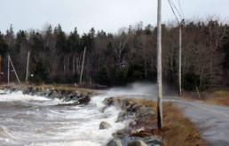
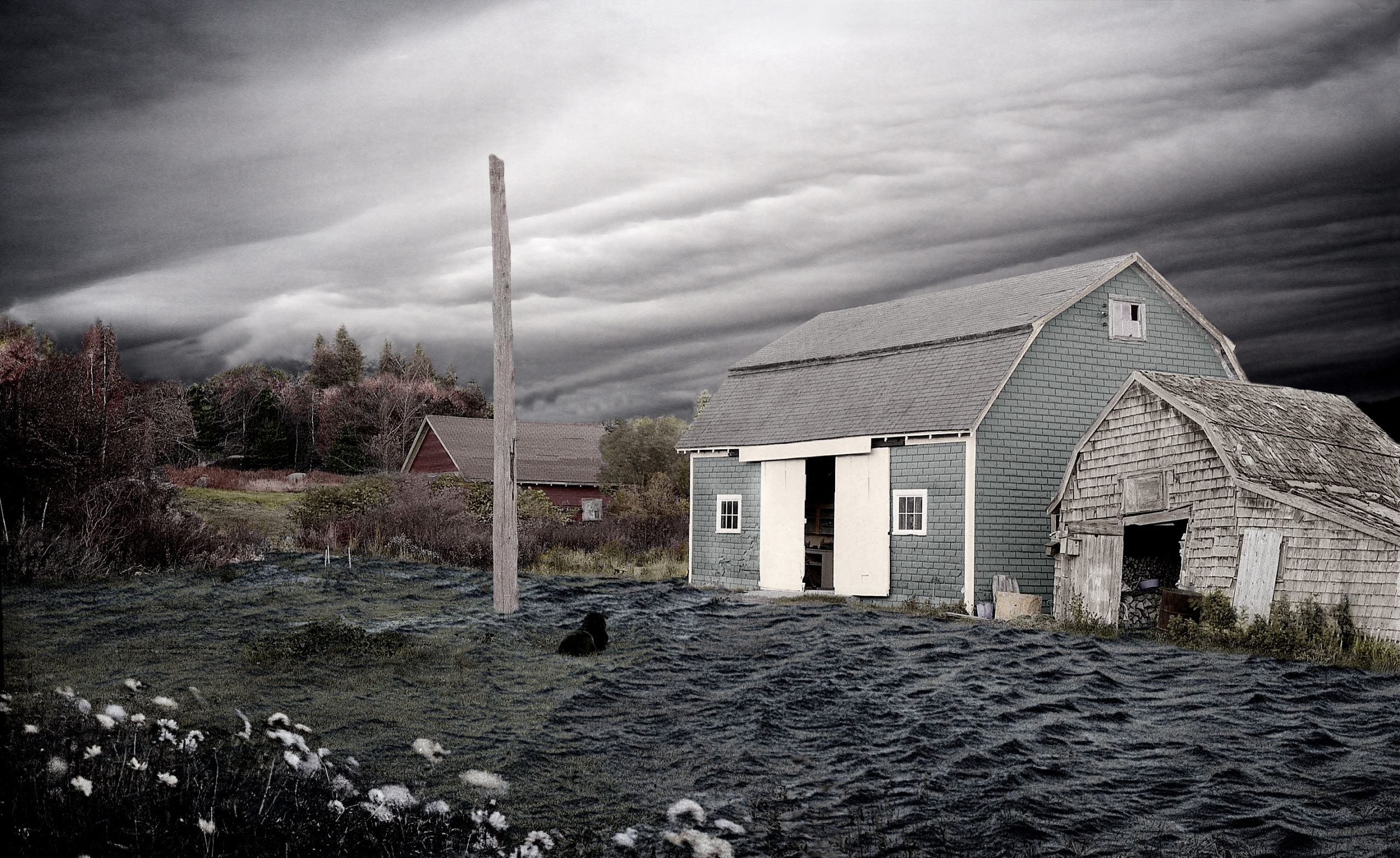
As the Gulf Coast waited for Hurricane Michael to make landfall in the fall of 2018, residents of the Tanyard a low-lying, low-income community in Pensacola, Florida, posted updates on their online neighborhood bulletin board. Gloria Horning, co-president of the Tanyard Association, wrote, “Folks, please check your storm water drains. Clean them to allow water to drain during the storm.”
A day later she uploaded photos of a flooded South Devilliers Street with the caption, “It hasn’t even rained yet.” High tide was working its way into the neighborhood through the very underground infrastructure that was supposed to usher water out. Other members sent links to locations where residents could get free sandbags, lists of local evacuation shelters, and minute-by-minute updates on the city’s emergency preparedness plan.
As flooding has become more common and internet access widespread, groups like Horning’s have started popping up across the nation. There is “Thomas Flood & Mud Watch Updates for Ventura & Santa Barbara Counties” ; and “Fix Flooding First!” in Charleston; “Houston Flood 2015 & Beyond: Support and Resource Group”; and “Acadiana Flooding Message Board” in Lafayette, Louisiana. Some have 20 members, others 12,000. Most began with the goal of helping residents weather a particular storm and then access the resources made available for recovery.
During big hurricanes, like Michael, folks post information about who needs to be rescued and where. Then, in the aftermath, members ask and respond to questions: How do you file a National Flood Insurance claim? Which companies are best at lifting homes? And, can you pursue this option if yours is built on a slab?
Anyone who has lived through a flood will tell you this much: it’s deeply unsettling. You watch the water creep under the door and know that soon the floor will buckle. That the sheetrock will need to go and the family photos will warp.
That the home you built, made your life inside of, is in the process of coming undone.
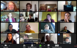
A screenshot of a video meeting reveals
how people across the country are building
grassroots networks.
But when one flood becomes two, then four, then eight, can-do gumption turns into curiosity about causes, and a desire for justice. Along with human accelerated climate change, development practices have also amplified the disruptive power of unprecedented weather events.
I have been reporting on flooding and the early effects of sea level rise since 2012. During that time, floods and extreme rainfall events—events that once felt like isolated and isolating experiences—have become more common. With this increase in frequency, many of those living on the front lines of climate change are waking up to the fact that they are not alone and that the floods they suffer are, in many ways, man-made.
From Wetlands to Wet Lands
Wetlands act as giant sponges, absorbing both storm surges and rainfall during extreme weather events. But when they are paved over, that water still has to go somewhere. Over the past 200 years many states along the Eastern Seaboard and Gulf Coast have lost over 50 percent of their wetlands to development. And in some metropolitan areas the statistics are mind-boggling. From 1992 to 2010, Harris County, Texas (of which Houston is a part) lost 29 percent of its freshwater wetlands to development.
“We don’t often talk about it, but the way we have developed in low-lying areas amplifies the destructive power of these storms,” says Alan Benimoff, a professor of Geology at the College of Staten Island in New York City, one of the areas hardest hit by Hurricane Sandy back in 2012.
As more and more citizens become aware of the ways in which the development of coastal and freshwater wetlands can increase flooding in adjacent neighborhoods, the mission of these citizen flood groups is evolving. Once the floodwaters recede and life takes on a feeling of normalcy, many have begun to fight future development projects sited atop wetlands.
Residents Against Flooding in Houston began after a thunderstorm inundated the Memorial neighborhood. When events like this repeated themselves, again and again, culminating in the catastrophic flooding that accompanied Hurricane Harvey, urgency around the fight to keep wetlands free from development reached new highs. The group recently filed a federal lawsuit against its Tax Increment Reinvestment Zone, which argues that the board of this public entity facilitated wetland development without the accompanying and legally-required storm water detention, causing neighborhoods that never flooded before to find themselves regularly underwater.
In the fall of 2018, while reporting on the Hurricane Florence recovery, I joined a Zoom meeting set up by Harriet Festing of Flood Forum USA. Founded in April of 2017, on the eve of the single most costly hurricane season in U.S. history, Flood Forum USA is the first nationwide coalition designed to help flood survivors get organized, heard, and supported.
I sipped my green tea as my screen populated with people from around the country. Gloria Horning beamed in from Pensacola and Beth Butler joined from New Orleans. Gabriella Velardi-Ward, the Coordinator for the Coalition for Wetlands and Forests in Staten Island was in attendance, as was Cynthia Neely from Residents Against Flooding. Twenty-seven leaders from dozens of different citizen groups aimed at preventing or reducing future flooding joined in. And while, as of the time of writing, Flood Forum boasts no partner organizations in Maine (though hopefully this story can help change that), the nearby Seabrook-Hamptons Estuary Alliance in New Hampshire and the Massachusetts Coastal Coalition are both members.
Every month, Festing organizes a call to connect local leaders to the information they need. In this case, the call covered how and when to mount a lawsuit against unlawful wetland development. The speaker for the afternoon was attorney Eric R. Nowak of Harrell & Nowak in New Orleans, who explained what was required in order to file such a case and the opportunities for success. The tone was one of conviviality and care, and throughout the hour I watched Festing take notes on what kinds of resources were needed by whom.
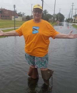
Boots on the ground, and in the ballot booth.
“I don’t want each of these local leaders to have to reinvent the wheel every time they are underwater,” she would later tell me. It seemed like a reasonable goal, one made perversely more possible by the existential and social threat flooding increasingly poses as cities around the world continue to pave over their remaining natural defenses while storms get stronger, and the very rate at which sea levels are rising accelerates.
Flood Forum—which has, in the year since its founding, already attracted more than 25,000 members—plays matchmaker, connecting local activists to the support they need in order to address the issue in an equitable manner. It introduces frontline communities to scientists, designers, and lawyers who are willing to donate their time and expertise to help residents understand their flood risk, communicate those risks to local representatives, propose long-term solutions, fight future wetland development, and hold developers who have unlawfully built in wetlands financially accountable for their actions.
All around the world, increased flooding is unsettling our very idea of who we are, where we come from, and the places we call home. And yet, in a strange twist of fate, these events are also bringing communities together even as they simultaneously threaten to break them apart.
Increasingly, local groups are organizing to
urge regional, state, and federal leaders to
address rising seas.
We talk about resilience as if it were something we could add to the built environment by turning seawalls into dunes, and replacing concrete with rain gardens. This is one half of the equation and it is the costly half at that. It’s the half that many places aren’t likely to get because they have long been at the bottom of various municipal lists.
To all, but especially to those whose neighborhoods have always been under threat, let us also define climate change resilience this way: it is a human act, one of coalition building and fostering solidarity, one that promises to rewrite power relationships, and even mend our relationship with the land, as we continue to recognize that this vulnerability is widely shared.
Elizabeth Rush is the author of Rising: Dispatches from the New American Shore (nominated for a Pulitzer Prize in the general non-fiction category) and Still Lifes from a Vanishing City: Essays and Photographs from Yangon, Myanmar. Her work explores how humans adapt to changes enacted upon them by forces seemingly beyond their control, from ecological transformation to political revolution.
Resilience is the Response to Rising Waters
Resilience is the Response to Rising Waters
Maine’s rocky shore protects, but doesn’t prevent sea level rise.
BY STEPHANIE BOUCHARD
The iconic rocky coast of Maine. It has awed and wooed people for centuries. It has also helped fuel the state’s economy, as those it has beguiled flock here. And, it turns out, it helps protect us from the unfolding and increasing impacts of climate change—specifically, sea level rise.
Sea level rise. If you live along the coast or on the islands, you’ve certainly heard of it. Probably, you are already living with its impacts, even if it isn’t causing major disruption to your daily life.
If you aren’t living on the coast or islands, you certainly have heard about it, indirectly, in news reports in the guise of storm-related flooding. You may remember Winter Storm Grayson in January 2018, for example. The blizzard caused flooding all along Maine’s coastline.
Scarborough had to close a section of heavily traveled Route 1 along the Scarborough Marsh, and the town’s iconic Clambake Seafood Restaurant’s parking lot was submerged as ocean water gushed into the building itself.
Lincolnville Beach, Port Clyde’s commercial fishing pier, and parts of Portland saw extensive flooding, too. Portland actually came within a hair’s breadth of reaching its highest storm tide on record—the infamous Blizzard of ’78, which had a storm tide of 14.1 feet. Instead, the city recorded its second highest storm tide at 13.25 feet. A certain amount of flooding during severe storms is expected by anyone who lives near the ocean; however, as seas rise, even mild storms are causing significant damage and inconvenience.
As ocean and climate scientists will tell you, sea level rise isn’t a new phenomenon. The world’s oceans have been rising for centuries. So why all the concern today? Sea level rise is having a more profound and noticeable impact, resulting in incalculable costs to life, human and non-human, and property.
Sea level rise is mainly driven by two factors: warming oceans and melting land ice, such as the ice sheets of Greenland and the Antarctic, according to Gayle Bowness, the science education program manager at the Gulf of Maine Research Institute.
As land ice melts, that water is added to the world’s oceans, and warming water expands, which means it takes up more space. The Gulf of Maine, she noted, is warming faster than 99 percent of the world’s oceans.
How much the seas will rise—and how fast—is unknown and depends on a variety of factors, including a warming atmosphere and how the world’s ice sheets respond. On the low end of scientific estimates is a global sea level rise of three feet by 2100. On the high end, if the ice sheets deteriorate rapidly, estimates are projected to be as high as 11 feet.
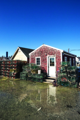
High tide reaches a building on Vinalhaven.
Photo: Jack Sullivan
While scientists work to understand how much seas will rise and by when, what is clear is that communities along the ocean need to prepare now.
Some communities are in dire straits already. In Miami, Florida, for example, residents face frequent flooding (even when it’s not raining) due to high tides. Charleston, South Carolina, in recent years has been experiencing tidal flooding in parts of the city that normally don’t flood from high tides.
These are places where drastic measures need to be taken now. But Maine is not necessarily one of those places, says Erika Spanger-Siegfried, lead climate analyst of the climate and energy program of the Union of Concerned Scientists, a Massachusetts-based nonprofit science advocacy organization.
“Maine is endowed with coastal elevation and rocky shores,” she said. “That’s an important first line of defense when it comes to sea level rise.”
Whereas more uniformly low-lying areas such as southern Florida, the Carolinas, and the Jersey shore are facing significant sea level rise impacts, the impacts of sea level rise in Maine will be less in terms of both land lost and how soon chronic flooding becomes a major issue.
“For some communities, they’re going to have to throw everything and the kitchen sink at this right away,” she said. But the state’s rocky stretches of shoreline provide somewhat of a buffer for a large portion of—although not all of—the coast, and that buys the state some time to undertake thoughtful and lasting resiliency efforts.
That’s not to say that the state is getting a pass, says Spanger-Siegfried. There will be problems with erosion, harm to fisheries, ecosystems, and properties, and storms that result in potentially huge losses.
But with this gift of time, she said, the state has the opportunity to become an example of how to engage in thoughtful planning that protects vulnerable areas and makes smart infrastructure investment choices that will ensure resiliency over the long term and across a variety of changes.
“There is the opportunity to use this time wisely,” Spanger-Siegfried says, “and to become a coastally resilient state.”
Gayle Bowness of the Gulf of Maine Research Institute agrees that Maine is uniquely positioned to take the lead in resiliency efforts to combat sea level rise, but doesn’t think it’s a good idea to be lulled into complacency.
Sea level rise, she notes, won’t happen on a “smooth curve of increase.” It can happen abruptly or in jumps and spurts. And we mustn’t forget the more-frequent occurrences of damaging storms. “So, yes, we have the time, but no, we do not,” she said.
Bowness talks to communities all over the state about sea level rise and potential resiliency efforts. She encourages them to think about the big picture—not to focus on just where the water goes—but to consider all the things communities need to function well: how to get in and out of homes and workplaces; knowing where there is access to food sources, emergency services, schools; and how supplies would get in if transportation routes are cut off.
And that’s what some coastal communities are already doing.
Impacted Communities
Several communities, including Damariscotta, Vinalhaven, Bath and Portland, have worked with engineers and scientists to create reports of the potential impacts of sea level rise and storm surge on their communities and to come up with solutions.
“When the city is working with … the many infrastructure changes that we contemplate, [sea level rise] is now part of the design consideration,” said Bill Needelman, Portland’s waterfront coordinator. That ranges from open space planning along the waterfront to development projects to pretty basic details, such as the need to ballast catch basins so they don’t pop off and float when flooded.
“If you’re going to spend money and just end up with exactly what you have right now, it’s all loss,” he said. “You can make yourself more resilient at the same time that you’re building your tax base and continuing to have a vital community.”
After having its sea level rise scenarios study done, Vinalhaven now approaches its infrastructure planning with an eye toward resiliency, said Andy Dorr, the island’s town manager. “We’ve got a long list of things we’d like to do, so it’s about prioritizing those things,” he said.
Part of that is taking advantage of natural lifecycle replacement for infrastructure such as bridges, sidewalks, and roadways. For instance, Vinalhaven’s Carrying Place Bridge is in poor condition and will soon need to be replaced. As the town discusses the design for a replacement bridge, it’s considering whether or not the bridge should be raised to a height that will accommodate rising water over the expected lifetime of the new bridge.
While communities along the waterfront are getting themselves informed about the impacts of sea level rise and some even have resiliency plans in place, the biggest obstacle to realizing those plans is money.
The town of Damariscotta, like other communities, used grant money to fund a study projecting sea level rise scenarios for its historic downtown, but finding funding for making the recommended infrastructure improvements has been challenging, said Town Manager Matt Lutkus.
Planned infrastructure efforts for Damariscotta, some of which are underway or completed, include enhancing a park bordering the harbor; sidewalk and culvert replacements; improvements to the public parking area along the harbor; and installing a flood wall to protect the downtown.
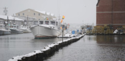
Waves batter a road on Islesboro.
Photo Courtesy: Doug Welldon
All these improvements will cost the town millions of dollars.
Grant money exists to fund studies, he noted, but most infrastructure grants either go to communities with more dire needs or don’t provide enough money to enable the town to get projects completed. So, Damariscotta has been tackling the projects it can—often with the help of private donors—in the hopes that future generations can build on what is being done now.
Finding money for expensive resiliency improvements is difficult, agreed science educator Gayle Bowness, but, “We don’t want to be put in the position of needing to react,” she said. As expensive as it will be to be proactive—and everyone agrees it’s going to be whopping expensive—reacting is much more costly, she noted, on an economic level as well as an emotional one.
“What we need is to have everybody on the same page because what’s needed is change and change is hard,” she said. “We do have this opportunity. We have the data and we have the time to make some smart decisions. But it’s going to take support and we’re going to have to be open to change. It doesn’t mean we can’t have our coastal communities and our working waterfronts. It doesn’t mean that goes away. It means it’s going to need to be different.”
Stephanie Bouchard is a freelance writer and editor based in the Midcoast. Find her at www.stephaniebouchard.net.

Folio: Lines (57° 59' N, 7°16' W)
Pekka Niittyvirta and Timo Aho
Lines (57° 59′ N, 7°16′ W)
Interactive site specific light installation at Outer Hebrides, Scotland
By the use of sensors, this installation interacts with the rising tidal changes activating three synchronized light lines by the high tide. The work helps us to imagine the future sea level rise in an undefined period of time, depending on our actions to address the warming climate.
The installation explores the catastrophic impact of our relationship with nature and its long-term effects. The work provokes a dialogue on how the rising sea levels will affect coastal areas, its inhabitants, and land usage in the future. This is specifically relevant in the low lying island archipelagos like Uist in the Outer Hebrides off the west coast of Scotland, and in particular to Taigh Chearsabhagh Museum & Arts Centre in Lochmaddy where the installation is situated. The center cannot develop on its existing site due to predicted storm surge sea levels.


Folio: On the Water
On the Water
ABE GOODALE
Abe Goodale spent the past dozen years working internationally as an artist and wilderness guide. He recently returned home to Maine to focus on work connected to the local waters he grew up on.
Following in the footsteps of his great-great-grandfather Charles Dana Gibson, Goodale focuses on portraiture and the representation of an era. He sees the arts as a platform to instigate change and preserve culture. He spent last fall on the water and then through the winter created watercolor representations. They are a tribute to the hardworking men and women who make their living along the coast and an industry that is thriving, yet fragile.


Folio: Altered Realities
Altered Realities
JEFFREY C. BECTON
Working year-round from his Deer Isle studio, Jeffery Becton draws from a vast collection of photography of his natural surroundings, local homes, and personal imagery to create his striking compositions. His images, which he describes as digital montage, exist somewhere between photography, collage, and painting.
Becton is one of the pioneers of the digital revolution, and his work spans the generations of Maine’s artistic tradition.

Upstairs Chair
Two Bush and Beyond

The Pilot House

Spring Tide
Portent

Inundation With Pink

Home from the Sea

Hardscrabble

Guesthouse
Off Spirit Ledge
Maine Islands: Paintings From the Farnsworth Collection
Maine Islands
Paintings From the Farnsworth Collection
The Farnsworth Art Museum’s collection of approximately 15,000 works focuses on American art from the 18th century to the present, with a special emphasis on artists who have lived or worked in Maine. Since the mid-nineteenth century, the state has been both host and inspiration to many of America’s most noted painters. Drawn here by Maine’s physical beauty, they found subjects for their work that sustained them and, in some cases, defined their careers. The museum’s earliest acquisitions thus often depicted not only Maine’s scenic coastline, but its stunning islands as well.
Jan marinus Domela (1896-1973)
Monhegan Island, 1938
Oil on canvas
Bequest of Mrs. Elizabeth B. Noyce, 1997
Monhegan Island shows the village, harbor, and Manana Island in the distance under the bright sunlight and dramatic shadows of a late afternoon, during a time when Domela was painting with friend and resident island painter Jay Hall Connaway.
George Wesley Bellows (1882-1925)
Beating Out to Sea, 1913
Oil on board
Museum Purchase, 1945
One of the earliest acquisitions by the Farnsworth Museum, Beating Out to Sea is among the hundred works George Bellows painted on Monhegan Island during the summer and fall of 1913. This study reveals the immediacy of his experience with the sea, and energy that he felt and so quickly expressed with brush on board. This painting captures an instant but suggests ever-changing color, the sound of pounding, deep, cold, water against slippery hard rock, and the feel of salt spray and heavy wet fog.
George Wesley Bellows (1882-1925)
The Fish Wharf, Matinicus Island, 1916
Oil on panel
Bequest of Mrs. Elizabeth B. Noyce, 1997
In the autumn of 1916 Bellows and his wife Emma stayed on Matinicus Island, a thriving fishing community 20 miles off the Maine coast. Bellows completed several paintings and many sketches of this productive trip. Later, he painted scenes from memory, and wrote that it is the artist who makes life more interesting or beautiful, more understandable or mysterious, or probably, in the best sense, more wonderful.
Sanford Robinson Gifford (1823-1880)
Rocks at Porcupine Island near Mt. Desert, 1864
Oil on canvas
Museum purchase, 1998
Sanford Robinson Gifford focused on the fleeting effects of light during his painting trips abroad and in the United States. While Civil War battles raged elsewhere, Gifford joined fellow painter Jervis McEntee on a three-week visit to Mount Desert Island, filling sketchbooks with impressions of the landscape made during treks from a rustic cabin on Cadillac Mountain. When he returned to his New York studio, Gifford made oil studies from his sketches of the island, one of which resulted in this painting. He rendered a sailboat in the distance against a cloudless blue sky, but in a single brush stroke, suggested in the foreground a tiny dinghy, buffeted upon swirling cold waters at the foot of a sheer cliff. Smashed by whitecaps, this unmoving rock at the edge of Porcupine Island appears too powerful to crumble from encroaching plant life or the force of salty spray.
Raphael Soyer painted The Boatyard on the island of Vinalhaven, located just off the coast of Rockland, where he summered from 1957 until the end of his life. Vinalhaven’s attraction was, in Soyer’s words, that it was “naturally picturesque” and that it “acquired a peculiar charm that semi-abandonment and isolation give.” He established himself as a painter of the gritty urban scene in New York in the 1920s and 1930s, featuring ordinary men and women in their homes, at work, and at leisure, but landscape subjects became more frequent in his work upon his arrival in Maine.
Raphael Soyer (1899-1987)
The Boatyard, Vinalhaven, c. 1950
Oil on canvas
Gift of Mrs. Elizabeth B. Noyce, 1996
© Estate of Raphael Soyer, courtesy of Forum Gallery, New York, NY

Rockwell Kent (1882-1971)
Maine Coast, c. 1907
Oil on canvas
Bequest of Mrs. Elizabeth B. Noyce, 1997
Rockwell Kent, one of several painters to follow the advice of the influential American painter and teacher Robert Henri, came to paint on Monhegan as early as 1905. Maine Coast exhibits Kent’s graphic vision and command of color in his emphasis of the stark beauty of island snow under a wintry sky. Kent financed his years at his self-built Monhegan home and studio by working alongside islanders as a lobsterman, well driller, and carpenter. His experience of the island’s dramatic sea and land in all seasons inspired him to embark on decades of far-flung northern adventures to Newfoundland, Alaska, Greenland and Ireland before returning to Monhegan 35 years later.
Alvan Fisher (1792-1863)
Sutton Island, Mount Desert, c. 1848
Oil on canvas
Museum purchase, 1960
Alvan Fisher painted a number of romantic views of Mount Desert Island based on sketches he made during a tour of the area in 1847 and 1848. This was at a time when dramatic depictions of Mount Desert scenery were causing a surge of artistic and popular interest in the island. Fisher emphasized the island’s rugged beauty, somewhat tempered by human intervention. In Sutton Island the darker shape of the foreground cliff acts as a framing device, like a theater curtain that is swept aside, to reveal the sailboats and tiny figures bathed in sunlight. Fisher’s scene is symbol and promise of growing tourism along Maine coastal waters.
Willard leroy Metcalf (1858-1925)
Ebbing Tide, Version 2, 1907
Oil on canvas
Gift of the Estate of Sylvia Benson Lawson, 1982
Willard Metcalf was noted for his ability to evoke a sense of the actual experience of place in his paintings. The scene of pale rocky islands set against sparkling blue water and bright sky in Ebbing Tide exemplifies the best of Maine’s summer vistas on Penobscot Bay, while betraying little of the unhappiness felt by its author. Painted from the North Haven dock of friend and fellow artist Frank Benson during a time of retreat from his broken marriage, Metcalf’s view depicts the Fox Island thoroughfare between North Haven and Vinalhaven islands. Metcalf dedicated the seascape to Benson, whose caring family helped him through his period of despondency.
The Laboratory by the Sea
The Laboratory by the Sea
Biological Lab’s connection to nature informs its work.
By CARL LITTLE
Photos by LINDA COAN O’KRESIK
In the late 1800s, biology was becoming a real science and profession. The discoveries of Alexander Humboldt, the publication of Darwin’s The Origin of Species, and the classification work of Jean Louis Rodolphe Agassiz had spurred interest in diversity and evolution.
One place where biologists could easily access many life forms was the marine environment. At the turn of the 19th century, marine research stations were being set up all over the world. One of them, the Tufts Summer School of Biology, opened at Potts Point in South Harpswell on Casco Bay in 1898. The first summer, eight students and their teachers hauled seawater half a mile to a small cottage that served as laboratory and dorm.
In 1920, affluent Bostonian George B. Dorr, the main driver behind the creation of Acadia National Park, decided there should be a marine research station on Mount Desert Island. He knew about the South Harpswell laboratory and came up with a plan to move it to the former Thomas Emery Farm in Salisbury Cove. He touted the property’s beneficial qualities: “good wharfage opportunity, its picturesque character, its old farmhouse and the pure water…coming in a deep continuous channel from the open sea.”

The station would be a place for scientists to go in the summer to study marine organisms. Dorr felt the station would provide “a delightful contrast to Bar Harbor’s fashionable life.”
In fact, the arrangement aligned with the well-established rusticator tradition whereby college presidents, clergy, industrialists and other esteemed and well-off individuals and their families spent their summers on the island in retreat from East Coast cities. As Charles Eliot, president of Harvard put it, the scientists would be “invigorated, ready to do more valuable work the whole winter through in consequence of this climate boon and stimulating change.”
In recounting the history of the lab—which became The MDI Biological Laboratory—Jerilyn Bowers, its development officer, explains how the physician-scientists who arrived in the 1920s and 1930s believed that marine organisms might help them address medical challenges. Physiologist Eli Kennerly Marshall (1889-1966), for example, wanted to understand how the body could retain drugs longer and thereby increase their effectiveness. In studying the physiology of the kidney, he discovered that certain fish had complex filtration units. His studies of goosefish, caught in nearby waters, led to a new understanding of how the kidney functions.
Because the lab attracted scientists from around the world, the research was varied. One avenue of interest was environmental issues, including the effects of DDT and other toxins on fish and the impact of crude oil on sea birds. The underlying theme of the research is “finding the right model, whatever that is, to answer the question you are seeking to answer,” Bowers said.
End of Vacation Science
The model of doing research where scientists would pack up and go away for a summer of study started “dying very rapidly in the 1980s,” notes Kevin Strange, Ph.D., MDI Bio Lab’s president since 2009. Indeed, the lab moved to a year-round operation in 2000. And while the research facility remains by the water—fronting on Upper Frenchman Bay—its connection to the marine environment has decreased in the last 20 or so years.
The setting remains important, however. “Rather than doing science in a bunker somewhere in the middle of a big city,” says Strange, the lab is “keeping people connected to the natural world,” a connection he feels has been lost in the biomedical sciences.
While biologists can still learn a great deal from marine organisms, Strange points to economic realities to explain the lab’s shift away from the sea at its doorstep. Not long after arriving at the lab, he asked his team to review all the National Institutes of Health grants using search terms related to marine organisms. Out of 35,000, they came up with 25.

Jarod Rollins, faculty member and principal investigator at MDI Biological Laboratory, studies C. elegans, or roundworms, with the goal of understanding how life-extending interventions work across different species and applying what is learned to extend human health and longevity.
Faced with this state of affairs, the lab sought to diversify its revenues, in part by finding ways to commercialize its work. Many marine labs are adopting this strategy to survive. The Bigelow Laboratory for Ocean Sciences in Boothbay, for example, has taken up algae production. Its National Center for Marine Algae and Microbiota is a leading distributor of marine microalgae for science and industry.
In 2013, MDI Bio Lab spun off a for-profit company, Novo Biosciences, Inc., based on a molecular chemical compound, MSI-1436. First discovered by Michael Zasloff, M.D., Ph.D. in the dogfish shark on a visit to the lab in the 1990s, the compound has been shown to facilitate dramatic repair and hasten regeneration of complex limb tissues and heart muscle. Novo Biosciences received a major NIH Small Business Innovative Research grant in 2017 to take the drug candidate to the next stage, testing for commercialization.
“A lot of the stuff that we’re doing with industry—companies incubating on campus, trying to form our own companies where it makes both economic and strategic sense—that was a dirty word 20 years ago,” Strange says, “but it’s the reality of the world and it’s the right thing to do, too.” He points out that the lab is funded by the National Institutes of Health, not the National Academy of Sciences. “There’s a balance between pure discovery and where that discovery might have real applications,” he avers, “and the trick is finding that balance.”

C. elegans seen through a microscope.
“We’re not studying stem cells,” Strange explains, “We’re studying the animals that live in nature that have phenomenal regenerative capacities.” Among those creatures are the zebrafish and the axolotl, a kind of salamander. Both have the amazing capacity to regenerate lost body parts.
Voot Yin, Ph.D. and other scientists at the lab have been studying these creatures to learn how regeneration works and how to trigger a similar mechanism in humans.
The lab produces most of its own test animals. Animal care technician Karlee Markovich shows a visitor immaculate incubating facilities where the tiny creatures are raised. The animals reproduce quickly in captivity and are relatively inexpensive to house and utilize.
Strange and his team remain realistic about finding a breakthrough. “If you had a heart attack and you could reduce the amount of scar tissue by 5 percent,” Strange explains, “you’d be doing handsprings.” If the new drug works, it would also have potential applications for MS, spinal cord regeneration, and burn healing.
Education Central
“The Laboratory is a place for study and investigation, not for teaching,” wrote George B. Dorr at its inception. But today, education is a core part of its mission. The lab prides itself on its hands-on approach, offering 30 to 35 courses each year, training everyone from middle school students to practicing physicians and scientists. “It’s an important part of our economic diversification,” says Strange.
The lab is not interested in training more bench scientists. “We really focus on what people can do with a science education, whether in business, politics, law—you name it.”
This effort relates to a bigger push to produce a more scientifically literate society, and to place knowledgeable people in decision-making positions. “We’re living in a period where science doesn’t seem to matter much,” he states. “We have an Administration that has no interest in science, and wants to remove it from every discussion it possibly can.” Nevertheless, Strange believes science will “always prevail because it’s the way to understand the world around you.”
Kevin Strange, Ph.D., president of MDI Biological Laboratory in Bar Harbor since 2009, stands on the dock of the lab with Star Point in background.
The lab enjoys close relationships with a dozen research and educational institutions across the state, including the Jackson Laboratory and College of the Atlantic, both on MDI. The collaboration aims to develop a technically skilled workforce through biomedical research training for undergraduates; provide research support to young faculty to increase their competitiveness for federal biomedical research grants; and improve Maine’s research infrastructure through a network of core facilities with state-of-the-art equipment.
“Young people coming up now have a much broader perspective of science,” says Strange. “They’re not going to go off into an ivory tower somewhere and close the door; they want to solve problems.” The lab initiated a one-week course last summer, “Bridging Disciplines: Navigating Successful 21st Century Careers in Biomedical Science,” inspired by a couple of University of Maine students who recognized the need for cross-disciplinary training to keep their studies relevant in a rapidly changing job market.

Lynne-Beverly Staggs, a research assistant, examines zebrafish.
The lab has embraced the STEM movement and the increasing focus on entrepreneurship. At the same time, Senior Staff Scientist Jane Disney, Ph.D., the lab’s director of education, has been leading the effort to train citizen scientists. “We’re trying to instill a sense of place in students,” she explains, so that they return home with the tools to test and measure. “People learn better when they have something invested in the data they’re developing,” she says.
The lab offers special summer programs to engage and educate visitors. For several years, it mounted exhibitions highlighting connections between art and science. Last year four artists were “embedded” in the lab.
Additionally, the lab has increased its contribution to local, regional, and state economies. The lab has built two new facilities in recent years, using all Maine labor. Many of its 62 full-time employees live on Mount Desert Island. While the nearby Jackson Laboratory boasts a much larger work force, Strange believes that for its size the MDI Bio Lab has “a very substantial impact on this economy.”
He also insists that science and technology can “drive a robust economy.” He points to Maine’s “remarkable” number of R&D assets. Although the state lacks a long-term strategic plan to build on these assets, he sees no reason why it can’t be a regional leader in the field, considering its proximity to Boston. A $3 million bond issue approved by voters in 2014 allowed the lab to modernize and expand its infrastructure, which includes a new building, the Maine Center for Biomedical Innovation.
Karlee Markovich is an animal care technician at MDI Biological Laboratory’s animal facility who cares for more than 20,000 zebrafish.
Asked where he’d like to see the lab in ten years, Strange first addresses capacity: “We need more scientists.” While the lab should stay small enough to be able to adapt and move quickly, he notes, it needs to be larger, with “more people colliding with each other.”
One of those colliders, Aric Rogers, Ph.D., left his career as a meteorologist after seeing a special on television about the genetics of aging.
“I was fascinated by the incredible discoveries that were being made in many different animal species,” he recalls. After completing post-doctorate research at the Buck Institute for Research on Aging in California, he made his way to the MDI Bio Lab where he works with C. elegans, a roundworm nematode the size of a grain of rice. His goal? To find new therapies that slow aging and prevent or treat age-related illnesses in humans.

As the MDI Biological Laboratory moves further into its second century, it remains the laboratory by the sea, but its mission has expanded. With support from the NIH, the Maine Technology Institute, and other funders, the lab is now recognized as a world leader in regenerative and aging biology and medicine research. From the beginning, the lab was clear in its focus: advance human health. Its current commitment to anti-aging and regenerative strategies takes this focus to a new and exciting level.
Carl Little lives and writes in Somesville on Mount Desert Island. His most recent book is Paintings of Portland (with his brother, David). He is the communications manager at the Maine Community Foundation.

Grabbing the Digital Future
Grabbing the Digital Future
Islands explore ways to bring fast internet to boost economies, support health care and education, and sustain population
By Jennifer Van Allen
Malcolm Fernald’s internet service has been just fast enough to maintain a web site for his family business, the Islesford Artists Gallery. But if a potential customer wants to get a closer look at a painting or two online, he’s out of luck.
“Trying to upload high-quality images to email to a person would either take forever or not happen at all,” says Fernald, 34, a lobsterman who is chairman of the board of selectmen for the town of Cranberry Isles.
For Fernald, even beyond boosting business, an internet upgrade is critical to sustaining the way of life that has always felt like a refuge for him, and to maintaining his family’s ties to Islesford that have endured for generations. He’s banking on fast, reliable internet service to open up new social and economic opportunities for the town and reduce its reliance on fishing and tourism.
“Our economy is very dependent on lobstering,” said Fernald, who also chairs the town’s citizen broadband task force. “While that’s been strong for the last 20 years, it’s never a guarantee.”
In early 2018, the town learned it had won a $1.3 million grant from USDA to build a broadband network that’s faster than the national average—with download speeds of 25 to 100 megabits per second (mbps) and upload speeds of 5 to 20 mbps. Installation began in late 2017.
Cranberry Isles is one of 34 Maine coastal and island communities actively pursuing improved internet speeds with the assistance of the Island Institute. The Institute hopes to get all of Maine’s 120 coastal and island communities connected to internet speeds that meet or exceed the national average by the year 2025.
“Broadband has emerged as critical to sustainability of island life,” said Briana Warner, economic development director for the Island Institute, publisher of Island Journal. “These people already have a geographic barrier. We want to make sure that a digital divide doesn’t make that barrier even bigger.”
Page Clason prepares to snake the fiber
through a conduit on Islesboro.
Internet access is notoriously poor in rural Maine—below the level that the ConnectME Authority defines as “broadband,” and far below the speed standard set by the Federal Communications Commission, which is 25 mpbs for downloads, and 3 mpbs for uploads.
“In Maine—and for the islands in particular—it’s one of the huge holes in our ability to move forward,” said U.S. Rep. Chellie Pingree, who is a member of the House Rural Broadband Caucus. Pingree lives on North Haven.
In November, Pingree cosponsored The Broadband Connections for Rural Opportunities Program Act, which would make grants available to rural areas, funding between 50 percent to 75 percent of a broadband project’s cost.
“If we want to be prosperous nationwide we have to make sure everyone down to the last mile gets it, and encourage more funds to go into these last miles.”
The importance of faster internet emerged during conversations Warner held with islanders about their economic development priorities.
While residents weren’t necessarily clamoring for broadband, said Warner, the needs they identified—better access to health- care, education, employment, new markets for small businesses, attracting more seasonal and year-round residents—all hinged on improved internet service.
“They were listing all these reasons why they were having problems, and they all led to the issue of terrible connectivity,” she said. Each community’s challenges are unique, but their stories about the digital divide are often the same.
Businesses couldn’t operate credit card machines. Artists who wanted to sell their goods online had to travel to the mainland to upload high-resolution photos. Summer visitors couldn’t extend their stays and potential new year-round residents were
Businesses couldn’t operate credit card machines. Artists who wanted to sell their goods online had to travel to the mainland to upload high-resolution photos. Summer visitors couldn’t extend their stays and potential new year-round residents were turned off because they couldn’t work remotely. Schoolchildren were sitting outside after dark doing homework on the steps of libraries—the only source of fast internet. The sick and elderly were having to make arduous trips to the mainland to see their doctors.
“A house without internet is like a house without running water.”
— ROGER HEINEN
“Years ago, people looking for houses would ask about taxes, heating, and utilities,” said Andrea Galuza, a real estate agent in Arrowsic. “Now their first question is ‘What’s the internet access like?’”
A powerful example has been set by Islesboro, which embarked on an internet upgrade before the Island Institute’s efforts began.
In 2016, Islesboro residents approved a $3.8 million bond to build a broadband internet network which will provide access of 1 gigabit per second—that’s 40 times faster than the broadband standard set by the FCC and 300 to 500 times faster than what’s affordable to islanders now. Though this fiber optic service could be considered overkill for today’s island internet needs, the system had to be designed and constructed to be viable for future generations.
The network is owned by the town and operated by GWI. All subscribers pay a fee of $30 per month to cover the cost of connectivity and support, while the town pays off the construction bond and maintains the network infrastructure—which will bring a property tax increase of about 8 percent.
To Arch Gillies, broadband is just as critical to sustainability as other initiatives now underway, like the new preschool, and changes to town laws designed to stimulate more affordable multifamily housing for residents.
“There’s a realization that if we don’t do these kinds of things, we’ll fall behind the Midcoast pretty quickly,” said Gillies, chairman of Islesboro’s select board and a member of the broadband committee. “All the islands have summer residents who are very important to their economies. You have to look to the day when all these economies have to be much more varied in the event that tastes shift, and people say they’d rather vacation in Nova Scotia, Florida, or Australia.”
Roger Heinen, a former senior executive at Microsoft, began advocating for widespread internet access when he moved to Islesboro in 1996.
“These people already have a geographic barrier. We want to make sure that a digital divide doesn’t make that barrier even bigger”
— BRIANA WARNER
Before the upgrade, he was relying on a pricey point-to-point radio link that allowed him to work remotely. “It was weather dependent and had all sorts of issues, and it cost several thousand dollars, but it made it possible for me to work from my house, which was essential,” he said.
But it bothered him that his solution was beyond what most islanders could afford. “It caused this terrible problem of haves and have nots,” Heinen said. “Internet is an essential part of life now. A house without internet is like a house without running water.”
That’s why an important principle of the island’s broadband plans was that all residents would pay the same rate and get the same level of service. Another key facet of the project was that it would be owned by the town and have on-island tech support from GWI.
“It means we control our destiny,” said Gillies. “If it’s owned by someone else, they can always decide that it’s not profitable, or that we wouldn’t get some new aspect of technology. Also, we felt that we could do this at a better price and ultimately have better service than we might have gotten otherwise.”
But even beyond that was maintaining their fierce sense of independence that has always been one of the most cherished qualities of island life.
“This had to be a local solution to a local problem,” said Heinen. “No one was going to come to our rescue. It needed to be solved, and we had to step up and do it ourselves.”
In 2015, the Island Institute hired Tilson Technologies to assess internet infrastructure on 13 year-round islands, plus the seasonal Sutton Island, part of the Cranberry Isles. The study gauged how much residents were paying, how satisfied they were, and identified possible upgrades.

Roger Heinen in the building on Islesboro
that houses all customer fiber lines.
The Institute also held a broadband summit to help community leaders learn, network, and strategize. Since then, the Institute has been providing a wide variety of support services that include helping community leaders: write grants, research financing options, negotiate with internet service providers, and form municipally-authorized broadband task forces. The Institute also has awarded planning grants of up to $10,000 to fund engineered infrastructure designs that communities can put out to bid.
“We’re trying to fill whatever gaps the community has to help keep the projects moving,” said Stephenie MacLagan, an economic development associate at the Institute.
For the 3 Bridged Island Task Force that includes Arrowsic, Georgetown, and Southport, all three towns financially supported an engineering study, which was matched by a planning grant from the Island Institute.
On Vinalhaven, the Institute cosponsored a digital education workshop to increase know-how on programs like Quick Books. Events like this are often held at the public library, which has internet that’s 100 times faster than what they have at their homes. Even beyond showing residents how to reach more customers and work more efficiently, “These workshops show what’s possible with broadband,” MacLagan said.
But even without the Institute’s assistance, community leaders have pursued internet upgrades at a pace that has surpassed all expectations.
“Initially we thought a few communities would take it up, but it would be a long, hard slog,” said Warner. “Now 34 communities are actively pursuing better broadband. Our basic aspirations have been blown out of the water. These communities are taking control of their own digital futures. But they’re used to that. As islanders, they’ve had to do that forever.”
Even in areas where internet providers have made upgrades, longer-term solutions are being pursued. In the Hancock County town of Brooklin, Fairpoint upgraded DSL system in 2017 to provide 25/3 service.
“Fairpoint’s efforts have taken care of much of us for the short term,” said Bill Cohen, chairman of the board of selectmen in Brooklin. “The question is, what do we want as a community to position ourselves for 20 years out?”
Cohen sees broadband as a key to attracting more families and bolstering enrollment in local schools.
“We have been seeing a stagnation of young people moving into the community,” said Cohen, who is chair of the Brooklin Broadband Committee. “Local education is part of our vitality. But the fewer kids you have, the more expensive it is. And the less diverse.”
While many residents surveyed by Tilson for the Island Institute said they would be willing to pay more for better internet access, in some cases they may end up paying less than the expensive workarounds they’re paying for now. In the town of Cranberry Isles, the upgraded service will be available in three levels, for $65, $75, or $100 a month for residents. Though Fernald would pay at least $23 more a month for internet than he is paying now, and he estimates his property taxes will be about $17 a month higher to pay for the infrastructure, the upgrades will allow him to cut expenses elsewhere.
For example, the upgraded service is expected to be fast enough for VOIP (Voice Over Internet Protocol), so he’ll be able to use it to make calls, which means he will be able to cancel his landline. He’ll be able to stream his favorite shows, and eventually get rid of satellite TV, which costs $100 a month.
In Georgetown, Mark Aukeman, who works remotely as a technology consultant, was paying $175 per month to rent office space in Bath—just for internet service. Whatever the new system costs, said Aukeman, who chairs the 3 Bridged Islands Broadband Task Force, “It’s still going to be cheaper than renting an office.”
Jennifer Van Allen is a Yarmouth-based writer and author of four books. Her work has also appeared in The Washington Post, Runner’s World, The New York Times, The Working Waterfront andMainebiz. Learn more about her work at jenvanallen.com.

Painting Islands: Uniting Community with Art
Painting Islands: Uniting Community with Art
Islanders choose and light subject
By HOWIE MOTENKO
My project explores participatory art using the photographic technique known as “light painting.” My goal is to bring this public art work to all 15 of Maine’s unbridged, year-round island communities.
For each island, the collaboration begins with islanders selecting a subject—a place, a landscape—that resonates most strongly within the community. A team of volunteer islanders then assembles at dusk wielding handheld flashlights to “paint” the iconic scene with light, while I create a long-exposure photograph.
Each island’s shoot preparation is with the same general framework: scout the location months beforehand to determine the exact location and angle of the camera, previsualize the subjects and areas to light and others to remain in shadow, and consider where to hide people within the area (behind buildings, behind tress or rocks, and just out of the camera’s view). Each image is captured about 20 minutes after sunset coinciding with the “blue hour,” producing the vivid blue skies.
The well-grounded, formulated plan is just a starting place. At dusk, everything about the shoot becomes organic. This speaks to the creative, artistic process and makes the evening so special. No one, not even I as the photographer, knows what will be created as a final image. So many variables: who will participate, what kinds of flashlights, where will everyone be placed, what’s the weather, and when do we declare success.
The moment itself, when islanders illuminate the most significant image of their community, is as much a component of the art as is the photograph I make that captures it.
I believe each image’s beauty reflects the community’s spirit, trust, and camaraderie. I am grateful to each island community as it embraces the project and welcomes me as a partner.


For more information and to view all the images visit: www.paintingislands.com.
Howie Motenko lives in Seal Harbor on Mount Desert Island and works as a software engineer at The Jackson Laboratory. When not behind a computer, he enjoys photographing Acadia National Park. This project was funded in part by a grant from the Maine Arts Commission and has had the unwavering, immense support of The Maine Seacoast Mission.

‘Halfway to Where Somebody’s in Trouble’
‘Halfway to Where Somebody’s in Trouble’
Cell phones proliferate, but radios are the go-to communication tool on islands.
By Stephanie Bouchard
It is practically a cliché to call Matinicus Island isolated, but it is. The closest mainland city (and U.S. Coast Guard station) is in Rockland at about 23 miles distant. In the heart of winter, the state ferry may make one trip from Rockland to the island each month. Bad weather here has a more serious definition than it does in the rest of the state. Islanders use cell phones, but no one relies on them.
“Here on the island, if you’re not standing in just the right spot or facing the right direction,” says Clayton Philbrook, “you can usually text in a lot of places, but as far as having a voice conversation, it doesn’t work.”
What islanders do rely on is VHF radio. No matter where you are on the island, you can talk to those in boats five or six miles away, and sometimes farther, depending on the weather and the tides. Just about everybody on Matinicus has one, says Philbrook, who grew up on the island and has been lobstering there about 40 years. “There’s a lot of things you couldn’t do without one,” he says. “If nothing else, it’s a safety issue.”
Radios are in island kitchens, boats and road vehicles. In an emergency, Philbrook says, without VHF radios there’d be “absolutely” no way for those on land to communicate with those on the boats.
“The first person up at my house that goes out in the kitchen turns the radio on in the morning. The last one going to bed at night turns ‘em off,” Philbrook says. “You might be the only one that hears that [distress] call. We’ve had more than once around here that boats have gone down or gotten in big trouble. If somebody wasn’t listening, it would have been a lot worse than it was. We’re out here a long ways. We’re already halfway to where somebody’s in trouble.”
That help, via VHF, goes both ways.
Sometimes, islanders need the radios to contact those in the boats to come back home for an emergency on land, says Rachel Bishop, Frenchboro’s emergency management director, like if there’s a fire on the island.
Frenchboro doesn’t have a dedicated fire department so when there’s a fire, every able-bodied person is needed to help. “If it happens during the day, the fastest way to get ahold of the guys on the boats would be by VHF,” she says, “because it’s one call and you can pretty much get most everybody and anybody.”
Everyone listening to VHF radio can hear the conversations that take place over the channels. There are no private conversations over VHF. But that open transmission makes it easier and faster to respond, especially in an emergency, giving marine VHF radio a crucial and distinct advantage over cell phone communication—instead of contacting just one person (as with a cell phone), anyone listening to the channel you’re transmitting on can hear you and respond.
VHF is short for very high frequency and refers to the radio frequency range, sometimes called VHF maritime mobile band, between 156.0 MHz and 174 MHz. It is used primarily for navigation and to communicate ship-to-ship and ship-to-shore said Captain Leslie Eadie III, the master of Maine Maritime Academy’s training ship State of Maine.
“The first person up at my house that goes out in the kitchen turns the radio on in the morning. The last one going to bed at night turns ‘em off.”
—Clayton Philbrook
Nearly all fishing vessels have at least one, if not two, on board. These can be portable or permanently mounted and tied into a boat’s electrical system. Some vessels—those carrying six or more passengers, for example—are legally required to have a VHF radio on board, but most recreational or “pleasure” boats are not.
VHF communications are by “line of sight.” That means the antennas of VHF radios must be able to “see” each other for effective communication. Most marine VHF radios have a range between five miles and 25 miles, depending on obstacles, antenna height, the power of the specific VHF radios (hand-held ones have a maximum transmit power of three watts to five watts; fixed transmit power is between one watt and 25 watts), tide height (higher tides in port raise the height of boats and their VHF antennas, which raises the line of sight) and atmospheric conditions.
In certain atmospheric conditions, says Eadie, a phenomenon called ducting can happen. This is when a radio transmission gets trapped in a warm area between areas of cold air. The result is that the radio transmission travels a lot farther than it should be able to. Eadie said he has been out on the water when he heard radio conversations between boats 1,000 miles away from him. Fishermen near Matinicus Island have heard Bay of Fundy traffic control talking on VHF radio 154 miles away.
The federal government has rules about how marine VHF radio is used. For example, fines can be levied by the Federal Communications Commission (FCC) if people use profanities over the radio, says Eadie, although he isn’t aware of anyone being fined for such an infraction.
“It’s not unusual for a message such as, ‘Has anybody seen my husband? Send him home,’ to come over the VHF. ”
Those using marine VHF radios stand by on certain channels. The U.S. Coast Guard encourages users to monitor channel 16, which is reserved for distress messages and to call other boats. Once a non-distress message has been acknowledged by the intended recipient, the talkers should move to a working channel to keep channel 16 open. Radio listeners may also stand by on channels that other fishermen in the area use to communicate.
A radio conversation ties up the channel so no one else can use it until those who are using it sign off. That’s why conversation needs to happen on working channels rather than channel 16, and why conversations are supposed to be limited to navigational information, but, as anyone who uses marine VHF will tell you, interpretations of those regulations are broad.
Weather Reports And Gum Flapping
“They talk about all kinds of shit,” says Herman Coombs, who fishes out of Harpswell. “It can go from baseball to football to somebody teasing somebody about something. It’s not always about fishin’.” Sometimes the good-natured heckling is pretty amusing, but if the gum flapping gets to be too annoying, says Coombs, he will set one of his two VHFs to scan.
VHF radios are a part of the very fabric of life for fishing communities, so it’s no surprise that it’s used for all sorts of communications beyond navigation.
The radios are often used to communicate basic information between families on land and those working on the water. For instance, because VHF radios are practically everywhere on islands like Frenchboro and Matinicus, you can track down anyone anywhere—on land or on the water. It’s not unusual for a message such as, “Has anybody seen my husband? Send him home,” to come over the VHF.
Because of the long hours fishermen spend on the water, they’re often gone and working before the kids are awake, notes Bishop of Frenchboro. Once the kids are up, they may wish their family members out on the boats a good morning via VHF.
Kids from the elementary school sometimes do a morning weather report via VHF. Bishop says the weather report is a way for the kids to learn about weather and ocean conditions and get used to public speaking, but it’s really a special thing to the fishermen out on the water. At least one of them responds back to the kids when their report is over.
It is these personal moments shared over VHF that Herman Coombs’ wife Monique loves the most. She says one of her favorite memories of listening to marine VHF chatter was one evening when she and her husband were out on the water and they heard a grandfather wishing his grandson a goodnight. “That’s something you only experience in a fishing community out on the water,” she says. “It’s pretty special.”
Stephanie Bouchard is a freelance writer and editor based in Midcoast Maine. Find her at www.stephaniebouchard.net.
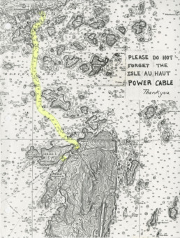
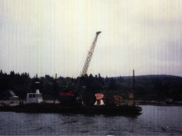
The DIY Approach That Linked Isle au Haut to the Grid
The DIY Approach That Linked Isle au Haut to the Grid
Cable has far outlived its life expectancy, thanks to Parker Waite’s problem solving.
By TOM GROENING
Parker Waite moved to Isle au Haut in 1976 “to get off the grid.” Though the phrase may have had as much figurative as literal meaning for him then, today he sees the irony in what occupied much of his time in the years that followed.
Waite was the nuts-and-bolts guy who established the electric cable linking the island with the electric grid. These days, the island is moving toward achieving a measure of independence from that cable, but it’s still operating, having exceeded its life expectancy by a couple of decades.
Before the cable, the island relied on four diesel-fueled generators. The success of that underwater cable is very much tied to the work Waite, now 73, did before the mainland switch could be thrown in 1983.
Waite’s educational background is in the arts, but his approach to bringing mainland electricity seven miles underwater to the island was very much like an engineer’s: gather information, think about site-specific adaptations, and dare to challenge conventional thinking.
Underwater cables connecting to Maine islands are laid either as a continuous cable or spliced as the sections are fed out of the hold of a barge or ship. In the second instance, the ship stops while a splice is made, then continues. Either approach, Waite believed, would mean the cable could be inadvertently strung across ravines and rock piles, which would make it vulnerable to getting hooked by fishing gear, and the cable itself would be subjected to enormous stress while being paied out. Using this method also meant the cable would be under tension; tide or storm current could cause a section lying over a sharp, rocky ledge to wear and break. “I didn’t want to run over any rocky spots,” he said. “It just chafes on the rocks, and I wanted to lay the cable out as gently as possible.”
At the time, a new underwater cable had just been installed from Rockland to North Haven by a large cable ship without tug support in a continuous run. It failed before it was turned on. “It didn’t make any sense to do it that way,” Waite said.
As he tried to figure out how to run the wire out safely, he hit upon a fresh idea: instead of paying out the cable in a straight line between mainland and island, he decided “to run it as a snake in a serpentine manner,” in sections of 2,000 feet to 4,000 feet, then make the splices later.
This unconventional idea came from his first-hand knowledge of the underwater landscape. He was a commercial diver who had chased everything from scallops to lost anchors between Mt. Desert Island and Vinalhaven. He had also done work for a repair job on the cable that runs from Swan’s Island to Frenchboro, so he saw up close how cables are damaged and repaired.
“I had crawled the bottom between Stonington and Isle au Haut. With that kind of knowledge, we had a vision of how the bottom looked,” he said. A boat with a fathometer that printed out the contours of the ocean bottom on paper tape supplementing nautical charts also helped. “You literally see it. I could see the gullies and ledges,” he said. “I wanted to go ‘smooth bottom’ as much as possible,” Waite said.
Using lobster buoys by anchoring them with old window sash weights, Waite mapped out the course that made sense. (Having worked as a lobsterman, he knew to first contact local fishermen to explain that he wasn’t encroaching on lobstering turf.)
Waite also investigated the nature of high voltage submarine cables. The industry standard used a metallic armor jacket, but he concluded that made the cable more difficult to handle and likely to fail.
He located a company that made a lightweight submarine cable with a new compound added to the polyethelene insulation which retarded the breakdown of the insulation, another problem leading to cable failure. The product, about an inch-and-a-half in diameter, has proven worthy. “It’s been down there over 30 years now. It’s mind-boggling,” he said.
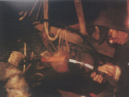
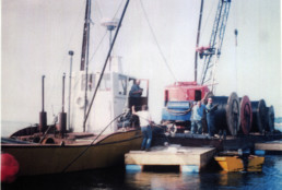
For the process of laying the cable, Waite sought out local and regional expertise. Locally, he got Charles “Russ” Devereaux, who operated a boatyard in Penobscot, to haul the cable on a “pusher” barge to the site. “He was the go-to marine contractor in this area,” Waite said. After his three years of prep work, Waite superivised Deveraux in running the six cable sections on the bottom from Stonington to Isla au Haut in just over two hours. The ends of each section were secured by rope to buoys awaiting the Boston-based splicer Jim Doucette to arrive in July when the seas were expected to be calm.
Devereaux and Waite built an oversized float/work platfrom with a table covered by an awning for the splicing work to be done on the water. “It’s really surgical,” he said of the exacting process of completing the five splices. “(The splicer) basically took a day to do each splice. He literally shaped every end of every copper wire that was in there,” linking the cable sections strand-to-strand with compression sleeves. A lead sleeve filled with a tar-like substance protected the splice.
The splicer managed the exacting work while he wasn’t feeling his best. “At the end of the first day, he was seasick,” Waite recalled. “And it was what I call flat-ass calm.” Having to focus on close-at-hand work aboard an even slightly rolling platform understandably took its toll.
While much of the cable-laying process went smoothly, Waite did have some close calls.
Once, for instance, Waite gave too much slack to the warp in a splice point in the cable laid in a deep hole between Hardwood and Merchant islands. In the tide the excess slack tangled in a rock pile and tied the cable to the bottom. A 135-foot dive was needed to untangle it with no one on the surface to assist. Normally, if you dive down to 130 feet for 10 minutes or longer, you’d need special equipment for decompressing to get back to the surface. It was equipment Waite didn’t have. He got the job done in about nine minutes.
And then, bringing the final splice point on board, Waite accidentally touched the positive and ground conductors at the same time while standing in a puddle of water on the deck. The static electricity that had built up over seven miles coursed through him. “It blew me right off my feet.”
The budget for the cable project was about $110,000, which would be shared by the 50 island ratepayers.
“I charged the company $1.50 an hour,” Waite said. “There was no money.” The cost to ratepayers was computed to be a one-time $1,500 fee. A wealthy summer resident suggested that he and his peers contribute to a fund managed by the church to help those unable to make the payment.
Last summer, sharing his story with islanders, he learned that the church fund had been replenished by locals.
Most of the phone calls in which Waite picked the brains of experts at electric utility companies, suppliers and contractors around the country were made on a “free” pay phone mounted to the exterior wall of the Atlantic Avenue Hardware store in Stonington. Later it became common knowledge that the phone was being tapped by the Federal Drug Enforcement officers responding to smuggling of illegal substances. Users had to enter an access code to get to the free service, but they were also unknowingly being recorded by law enforcement officers.

It’s been more than three decades since the pre-cable installation meetings Waite had with the island power company’s board of directors, when they discussed the potential of then-emerging technologies such as turbines that generated electricity from the wind and tide and photovoltaics that converted sunlight to electricity.
Those technologies have moved from theory to practical application in recent years, but in the late 1970s, it would have been a leap of faith for a small island community to invest in such equipment.
Today, the Isle au Haut Electric Power Company, a for-profit, member-owned cooperative, is pursuing solar power to meet its electricity needs. The plan would start with 486 solar panels while still relying on the cable, then add 954 more panels. Large-scale lithium-ion batteries would store electricity when possible, and a diesel back-up generator would carry the island through the dark months of November to January.
But as that plan takes shape, Waite’s cable remains.
And that guy who moved from Alaska to Isle au Haut to get off the grid, who then was instrumental in linking the island to that grid? “I got my come-uppance,” Waite said.
Tom Groening is editor of Island Journal.
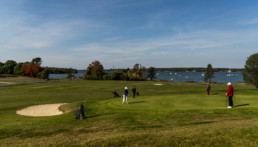
Island Golf Courses
Island Golf Courses
Rougher Roughs, Tidal Hazards and Gin and Tonics
By SELBY FRAME
PHOTOS BY GABE SOUZA AND SETH MACY
The sixth hole of the Great Chebeague Golf Club’s course, a 110-yard par 3, is ranked the easiest of its nine holes. That is, unless you fail to admire its sweeping views of Casco Bay.
Those who disregard the picturesque harbor below, the parade of sail and motor boats in the bay, and the beach roses clinging to the shore, may be levied a two-stroke penalty, by island custom.
Maine’s island golf courses have many such quirks. Three of these distinctive nine-hole courses are reachable only by ferry: The Tarratine Club of Dark Harbor course on Islesboro is renowned for its challenging, grass-covered mounds and sweet Penobscot Bay breezes. The North Haven Golf Club course wraps around a historic family cemetery and includes a ball-swallowing tidal inlet. And Great Chebeague’s course features water views from every green and several tees that shoot over a town road.
All have signature tournaments: Chebeague has its Swatfests, North Haven boasts a notorious G&T Invitational, and the rogue Islesboro Open matches plumber against patrician for a day of equal play.
Each of these seaside courses is shaped by history and leads players across infinitely discoverable landscapes. They are meeting places for generations of summer visitors and resting places for generations gone.
Their fairways can demark class—or invite surprising social connections. And all offer a hell of a good round of golf.
The oldest of the trio is the Tarratine Club of Dark Harbor on Islesboro, a natural, hilly course that is part of a private yachting-tennis-golf club founded in 1896 (the golf course later moved to its present spot).
The most difficult level of play for men from the blue tees measures 6,110 yards over 18-holes of play, with a rating of 68.4/123. Women’s red tees play 5,200 yards and rate 70.4/134.
It’s a decidedly private course, with two pros on staff and elegant, white-linen dining in the historic clubhouse, so unless you know a member, don’t expect to play a round. The course is known for its natural, hilly mounds and several holes of shoreline play that give it a true links feel. The fairway of the first tee offers stupendous sunset views of Gilkey Harbor and the Camden Hills beyond.

Those circumstances were masterminded, in part, by Tom Tutor, a now-retired island mathematics teacher who helped to pull off what one Dark Harbor doyenne reportedly called “the diplomatic coup of the century” when he and a Tarratine member organized the first Islesboro Open one fall in the early 1980s.
The unsanctioned tournament comingled summer and local players, an unprecedented contest that has evolved into twice-yearly scrambles that raise funds for local programs.
“We didn’t have any authority to do it whatsoever,” recalls Tutor. “We just publicly advertised that we were going to have a tournament. The fact that we could have an athletic competition that involved both year-round residents and some intrepid summer residents transcended some of the classic class lines and everyone enjoyed it.”
Subsequently, the club began offering a limited island membership for around $250 a season, with golfing rights after 4 p.m. and before noon on weekends. “Instead of sneaking onto the course,” Tutor says, laughing, “now we can pony up our annual fee, and if we stay invisible, we can play the course.”
The issue of greens access and enjoyment isn’t unique to Islesboro. Each of the golf courses bears witness to shifting island land ownership, from summering Native Americans to early American settlers to legions of well-heeled “rusticators” in the late 19th century who flocked to islands to build their summer cottages.
“We didn’t have any authority to do it whatsoever. We just publicly advertised that we were going to have a tournament.”
—Tom Tutor
The original plans for the Great Chebeague Golf Club course, which opened for play in 1921, indicated a settlement of teepees at what are now the first and second fairways. The island had been a summering spot for Passamaquoddy and Presumpscot Indians for centuries and still hosted them when the course opened.
At first golfers played around the “Indian camp,” as it was called, but tribal gatherings were later moved to a wooded parcel at the course’s edge. They continued to return there, selling sweetgrass baskets to visitors, until petering out in the 1950s.
This unusual bit of golf course history is part of what earned the club its 2015 certification on the National Register of Historic Places. Another is its quaint clubhouse, a farmhouse dating to the early 1800s that was moved to its present location not far from the Chebeague Island Inn, an independent property adjacent to the course where visiting golfers often repair after a round or two.
Chebeague’s is the only Maine island course on the registry and inspires “fanatic devotion” among its roughly 120 members, according to Linda Grant, the club’s archivist.
“Playing golf at Chebeague is not like playing anywhere else that we know,” she says. “We walk, and if we see a friend, we stop and talk with them. We will divert from the fourth green to the fifth tee to pick blueberries by the fence. We even stop and talk to people who come to play from off-island.”
The course is semi-private with daily greens fees ranging from $30 to $45. Remarkably, any island resident can play for free after 5 p.m. The club also has tried outreach to the island’s lobstermen over the years. “There are, I’m sure, year-round residents who feel like the club is exclusive,” acknowledges club president Carl Tubbesing, “but from the club’s standpoint we really try hard to be inclusive. We’re up against the fact of their lives, making a living mostly.”

The Chebeague course is the shortest of the island courses. Measuring 4,478 yards for 18 holes of white-tee play for men, it is deceptively challenging, with a rating of 62.2/102 for men and 65.4/109 for women. It requires golfers to play over ravines and roads, tee off on a working ferry dock, and hit a 140-yard water hole over a cove ringed with tall trees.
“It looks like a relatively easy course, but in fact, our course record is only six strokes under par and you can go wrong lots of ways,” says Tubbesing. It has three par 3s in a row and six par 4s with the signature seventh hole teeing from an Astroturf mat at the ferry landing on the Stone Pier.
The club is probably best known for its Swatfests–begun in the 1930s–a long-cherished tradition that brings out the whole island for rounds of sequential tee-offs leading to sudden death.
“Last year the youngest member was 6 years old and the oldest was 97,” remarked Grant, adding with a laugh: “Everyone is fearful of hitting the first ball because the whole island is watching you tee off.”
North Haven’s Cow Pasture
The 35-par North Haven Golf Club course has the wide-open, familial feel of what it formerly was—a cow pasture. Built on land that was once part of the Waterman farm, the hillside course overlooks the Fox Island Thoroughfare and includes the old Waterman family cemetery. (Balls landing on sacred ground get a free lift.)
Founded in 1916, the course has the distinction of having been designed by renowned links architect Wayne Stiles (1884-1953) of the firm Stiles and VanKleek. Its good bones and evolving course improvements have made it widely popular—and have even inspired other island clubs to spruce up course definition.
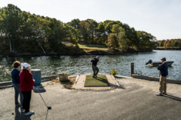
Officially, it is a private course, but daily public memberships are available for around $70. It’s a challenging course: There are six par 4s, a 598-yard, dog-leg par 5 at the fifth, and a monster of a par 3 at the sixth hole that plays over a tidal inlet to a green ringed with mounds.
Locals claim the tidal flat is white with lost golf balls at low tide, a bit of hyperbole, but a good stroke definitely earns major bragging rights.
It’s a relatively rangy course—6,246 yards from the tips for men’s gold-tee play for 18 holes (rating is 70.4/122 for men and 67.2/114 for women). The club has made a concerted effort to improve play on the greens, which, like many old courses, had become thatchy and spongy over time. It now plugs the greens during spring and fall, and around 15 years ago, brought in an expert golf course architect to provide ideas for improvement.
“(The architect) said nothing is wrong with the course, it’s just a little too easy,” said Jamie Davidson, a year-round North Haven real estate agent and clerk of the course.
The architect’s recommendation was to leave the grass between the fairways uncut. As a result, at the edge of the fairway, golfers encounter a very tall rough of tough grasses, which get taller as the season progresses. “If you can find your ball, well, I’m not strong enough to hit it out,” says Davidson.
North Haven’s standout tournament is the so-called G&T, or gin and tonic, an invitational begun in the ‘70s by a group of Colby College alumni, one who was then teaching on North Haven. He invited his buds over for some lubricated rounds, which evolved into an annual tournie accompanied by a tractor-trailer loaded with gin and Bloody Marys.
“It’s calmed down a bit now that the members are in their 70s,” chuckles Davidson, adding: “What I love about it is that in the spring or the fall you can go up in the afternoon after work to play golf and will often-times have the whole course to yourself. There are these long views—you can see Goose Rocks Lighthouse through a couple of fairways. It’s very relaxing.”
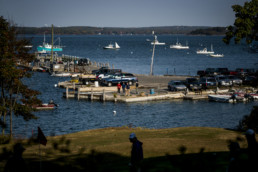
Whether access is sanctioned or not, Maine’s island golf courses offer natural respite that can be hard won during the work-filled or visitor-strewn months of summer. Ultimately, they are year-round public spaces where islanders walk dogs, push their children down sledding hills, and (I can say with some authority) meet sweethearts for moonlit trysts. The sea is never far, the stars are always wide—and a birdie is always on the horizon.
Selby Frame is a freelance writer and editor in Portland who has written about Maine artists, scientists, and everyday people for publications from the Maine Sunday Telegram, Casco Bay Weekly, Maine Times, Maine Public Radio, and Bowdoin Magazine. She currently profiles scientists and psychologists for the American Psychological Association and American Association for the Advancement of Science.