

Alchemy of the Night Sky
Alchemy of the Night Sky
Photographer Jim Nickelson uses the stars and moon as his palette
The moon’s an arrant thief,
And her pale fire she snatches from the sun
—Timon of Athens, William Shakespeare
I was the shadow of the waxwing slain
By the false azure in the window pane;
I was the smudge of ashen fluff — and I
Lived on, flew on, in the reflected sky.
—Pale Fire, Vladimir Nabokov

Pale Fire, Canto One I

Pale Fire, Canto One III
Using photographs of the night sky as raw materials, I attempt to find order in the movement of celestial bodies, just as philosophers and scientists have for thousands of years, a quest for order and meaning that relates to music, numerology, our relationship to the universe, modern cosmology, and beyond.

Pale Fire, Canto One VII

Pale Fire, Canto One VIII
Inspired by Vladimir Nabokov’s masterful poem novel Pale Fire, I build each piece by combining my photographs of the stars and moon. Canto One of my Pale Fire is directly inspired by the first four lines of the poem.
—Jim Nickelson

Pale Fire, Canto One IX

Pale Fire, Canto One X
Jim Nickelson is a fine art photographer, custom digital printer, and teacher and is currently represented by Kingman Gallery in Deer Isle. He has made his home in Camden with his wife and daughter for the last 14 years. Before committing himself to the photographic life, he pursued the classic artistic career path of NASA engineer and corporate intellectual property attorney (with a B.S. in Aerospace Engineering from the University of Texas at Austin and a J.D. from Harvard Law School). His work resides in museum, public, corporate, and private collections across the United States and Canada.

Pale Fire, Canto One XII

Pale Fire, Canto One XIV
Jim Nickelson’s work, including his series Pale Fire, can be seen as part of Archipelago Fine Arts Gallery show “Our Maine,” on display in the gallery at 386 Main Street, Rockland, through August 2, or online at theArchipelago.net through December 31. “Our Maine” features five Maine photographers: Jim Nickelson, Olga Merrill, Josie Iselin, Lisa Mossel Vietze, and Terry Hire. All prints are available for sale. For more information visit theArchipelago.net.
Islands of the Dawnland
Islands of the Dawnland
Native people relied on the coast for food and supplies
By Rebecca Pritchard
When Gluscabe was young, he watched his grandmother Woodchuck fish to feed the two of them, and saw she had a hard time catching fish. He decided to help her.
Gluscabe built a large fish weir across the entire mouth of the river, with a single opening in the middle. He went out into the bay and said to the fish, “The ocean is about to dry up. All you fish, swim up into my river and you will be safe!” The fish swam through the opening into the weir, and Gluscabe closed it.
Gluscabe went back to his grandmother Woodchuck, telling her they would never be hungry again. Grandmother Woodchuck came to see the weir full of all the fish in the sea, and told him he did wrong. Now there wouldn’t be any left for the descendants, she explained. “Put the fish back,” she said.
Gluscabe did. He opened the weir, telling the fish to swim free.
—The Wabanakis of Maine and the Maritimes, Maine Indian Publishing, 1989.
The above story is one told by the Wabanaki people of the region once known as the Dawnland, currently Maine and the Maritime provinces of Canada as far north as Newfoundland. Wabanaki refers to a confederacy of northeastern tribes.
For thousands of years, the Penobscot, Passamaquoddy, Micmac, and Maliseet people lived on the land and sea of the Dawnland, hunting, fishing, and gathering wild plants for food and medicine.
“It was our custom to follow the seasons and the migration of the animals and fish,” wrote Donald Soctoma, Passamaquoddy tribal historian, in the essay “Passamaquoddy History—A Brief Look Back.”
“In the winter we lived in the deep forest to hunt the large game animals, in the spring we gather at the first waterfalls of the river system to catch the large runs of salmon, in the summer we live along the coast to gather shellfish and fish in the deep ocean, and in the fall we follow the large game during the rut or mating season.”
The name Passamaquoddy is an Anglicized version of Peskotomuhkatyik, “the people that spear pollock.” The Passamaquoddy still live in the watershed of the St. Croix River of Eastern Maine and New Brunswick, Canada, but their ancestral land extended down to the Frenchman Bay islands.
Some traditional place names indicate what island areas were used for. The name for the sheltered village on the eastern shore of a large island in Frenchman Bay was Moneskatic, meaning clam digging place. This was named for the sandbar exposed with each low tide, the same feature Bar Harbor is named for today.
Sulessik, or seashell place, was the name for the island renamed Isle au Haut by the French explorer Samuel de Champlain in 1604. Shell middens throughout the islands provide archeological evidence that clams and oysters were plentiful, and a favored year-round food source.
Egg Rock off the shore of Bar Harbor was given the name Wawonok, which means eggs, according to Passamaquoddy artist and educator Geo Neptune. Such rocky islands were good for collecting eggs in the spring and hunting sea birds.
According to archeological record, seagulls, eider ducks, cormorants, and great auks were valuable food sources along the coast. Great auks, extinct since the 19th century, were flightless birds like penguins, but in the same family as puffins.
Fish weirs were constructed of willow rods in rivers and in tidal areas to catch schooling and spawning fish. Stone fishhooks like the ones on display at the Abbe Museum in Bar Harbor were attached to Indian hemp or basswood bark fish line to catch small fish, and large fish were harpooned from canoes.
When Maine became a state, it adopted the 1818 treaty between the state of Massachusetts and the Penobscot Nation. The only alteration to the document was the substitution of “Massachusetts” for “Maine.”
Seals and porpoises were also hunted by canoe, providing meat and valuable fat that could be boiled down into oil. The skins of these and all mammals hunted were scraped and boiled down into leather for clothing.
The coast had so much food in the summer that large summer villages formed. One such village was Astuwiku, the meeting place, on present day Mount Desert Island near Northeast Harbor.
Early French explorers encountered a chief named Asticou, the most famous chief in early historical record. But Neptune suggested in a 2018 article “Naming the Dawnland” that Asticou was the name of the place, mistaken for the name of the person.
With the coming of the French and the English and their battles to claim the “new” world that had been occupied since the last ice age, warfare and new disease such as smallpox disrupted traditional ways of life and decimated the Wabanaki population.
According to Harald Prins and Bunny McBride’s 2015 book Asticou’s Island Domain, a two-volume ethnographic overview and assessment for Acadia National Park, “90 percent of the Wabanaki perished in this American Indian holocaust,” which left the land and offshore islands “largely cleared for European settlement.”
Soctoma wrote that an 1812 census counted 360 people in the Passamaquoddy tribe, which “had been reduced by war and disease to a fraction of its former size.”
As detailed in Prins and McBride’s study, Wabanaki people continued to travel with the seasons as much as they could without trespassing on newly settled farms, and petitioned the government for tracts of their ancestral lands for their exclusive use, which became reservations.
Trading and selling products to settlers, and later to tourists on the coast, became a new way for Wabanaki families to support themselves. As Neptune explained, “Wabanaki encampments continued to make their appearance, and their locations were still chosen based on proximity to resources, but it was the resources themselves that experienced the biggest change.
“While Wabanaki people traditionally harvested food from the island, the arrival of Euro-Americans eventually created the need to survive in a currency-based economy, and Wabanaki culture adapted.”
Bar Harbor became known for its Indian encampments from the 1860s through the 1890s, in which Wabanaki families would camp through the summer selling ash, birch bark, and porcupine quill baskets, and guiding popular canoe excursions around the harbor.
Fishing, clamming, gathering sweetgrass from coastal marshes and making and selling baskets are continued by many Wabanaki people today. Conserving waterways and protecting fish stock for future generations, as young Gluscabe learned to do, is still a primary way of life for the people of the Dawnland.
Rebecca Pritchard lives in Bar Harbor. A reporter and former park ranger, she enjoys teaching and writing about Maine history. Her book Jeremiah Hacker: Journalist, Anarchist, Abolitionist is available in local bookstores.

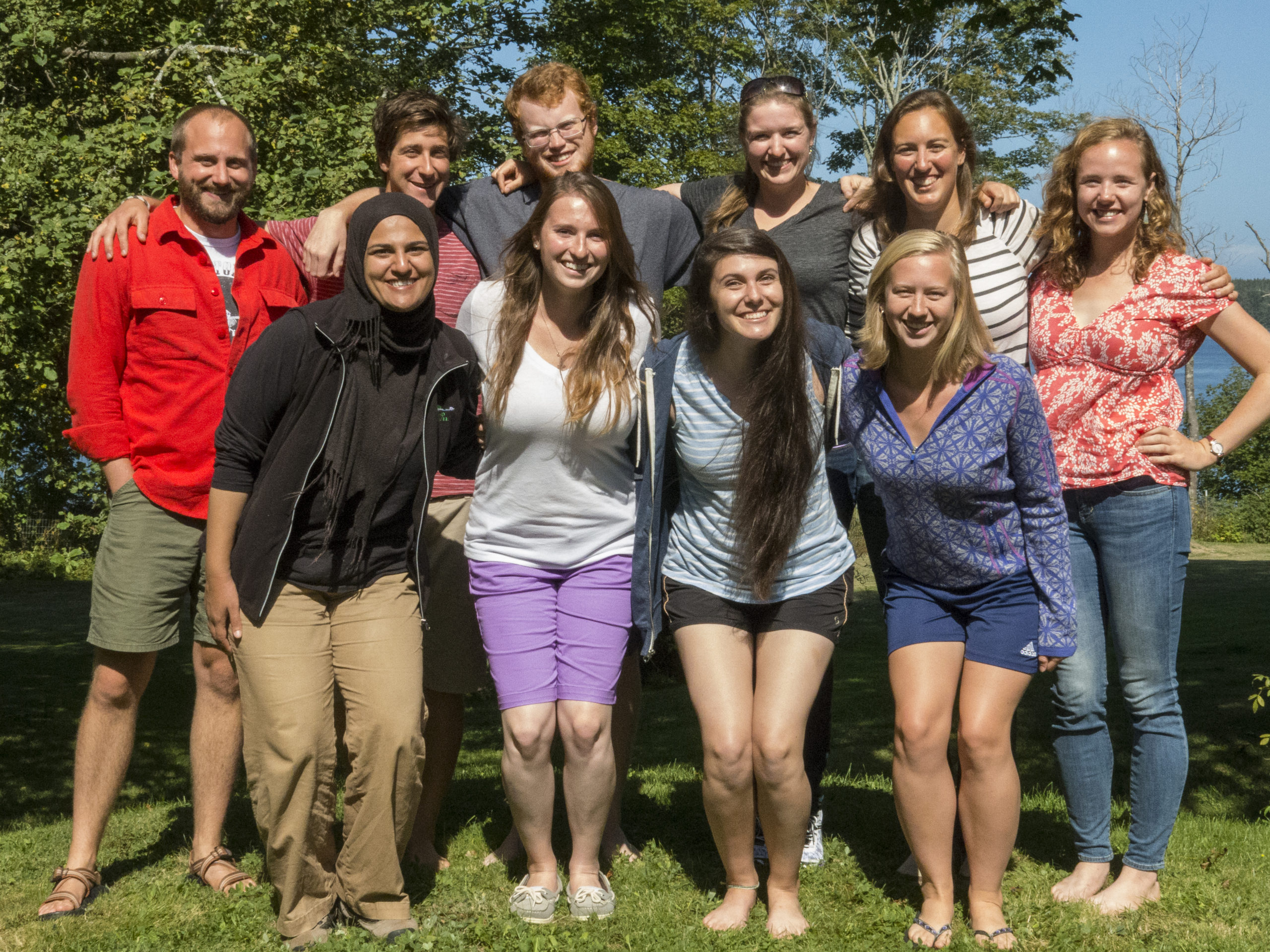
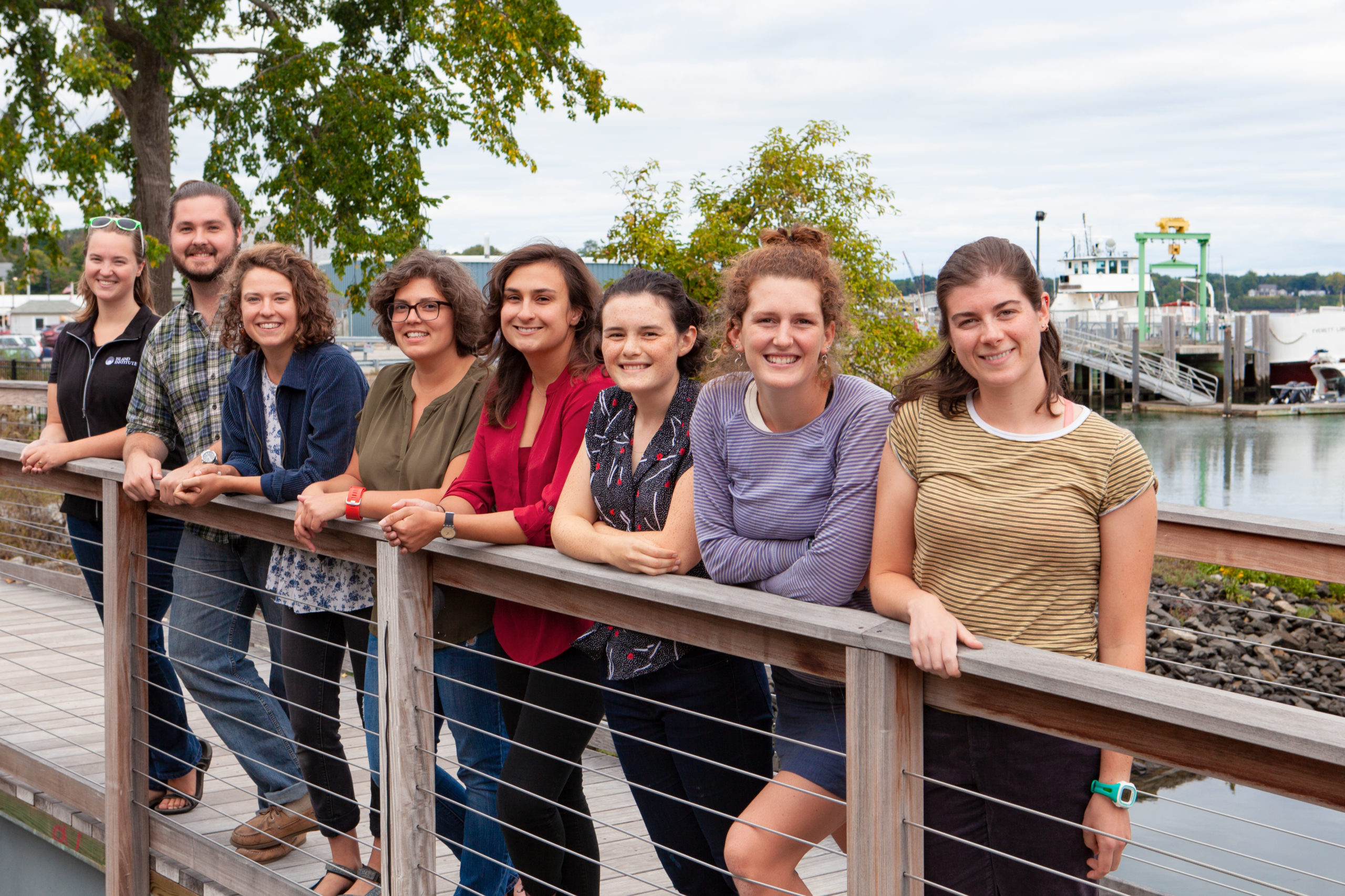
Two Decades of Fellows Changes Communities
Two Decades of Fellows Changes Communities
Advisors who serve as island-based mentors reflect on the program’s success
By Kendra Jo Grindle
It’s a beautiful coincidence that 2020 is the 20th year of the Island Fellows program at the Island Institute. Twenty years ago, the designers of this program may not have known the level of reach it would have. Fellows came from states thousands of miles away, their projects have touched every layer of an island community, and the power of the program has kept Fellows tethered here long after they take their final ferry to the mainland.
Long-time Vinalhaven Fellows advisor, Kathy Warren, who advised some of the first Fellows, recalls the impact as staying true to the original ideals for the program.
“There have been so many ways that they have given back and contributed to the capacity building of our communities,” she says. “They are community members, leaders, and friends. The contributions that they’ve ended up making to the life of the community, seems to me, are exactly all the things that I remember 20 years ago being the aspirations of when it was created.”
Former Vinalhaven Fellow Gillian Welch, left, sits with advisor Gabe MacPhail.
Fellows alumni, either from Maine or “away,” are not difficult to find. Taking a moment to look around at the change makers in Maine, you will see past Fellows. Kathleen Reardon (Islesboro, 2000) now serves as the senior lobster biologist for the Department of Marine Resources. Mike Felton supported educational curriculum development on Vinalhaven in 2000, which laid the foundation for his career as superintendent for St. George school system. Ben Algeo, now a legislative aide for the Maine Senate Majority Office, worked to lower energy costs for Monhegan residents in 2014. Fellows who worked at the Island Institute office also have grown in community development skills, furthering the sustainability of Maine’s islands and coast.
The program certainly has had a lasting impact on the Fellows themselves, but what about the communities and leaders the program has also shaped? Twenty years of harnessing the knowledge, professionalism, and relationships of strong community leaders and the richness of remote and rural communities has left its own unique mark.
Gabe McPhail, Vinalhaven’s community development and engagement coordinator and advisor to several Fellows, reflected on the enrichment the Fellows Program has brought to her.
“It’s been a privilege for me personally and professionally to experience someone else’s growth and evolution through their time here. Fellows bring rich, stimulating thought to my life and work—keeping the world and mind open beyond our community,” she said.
She described the systems-thinking approach Fellows bring to the community.
“We recognize that there’s a challenge in the system or a lack of capacity and Fellows come, focus on the project through a new lens, and address our needs alongside us by bringing their own experience to the table. I learn from and with them every time,” she said.
Echoing this sentiment is Donna Damon, who has advised Fellows on Chebeague Island and served as a trustee to the Island Institute when the Fellows program was founded. She described the impact Fellows have had on the school, historic preservation, and educating the community.
“Our community embraces Fellows. We learn from them while they learn from us. Their ability to remain neutral on community matters furthers their work and support.”
Fellows projects require the advisor and Fellow to strategize together towards the sustainability for the work completed over the 24-month fellowship. This sometimes means continuing through a new Fellow or leaving detailed plans for continued use. Occasionally, the work serves as a foundation for continued programming supported by the Island Institute.

“Fellows bring rich, stimulating thought to my life and work.”
—Gabe MacPhail
Anne Bardaglio, who was a Fellow on Matinicus in 2006, laid the groundwork for the Outer Islands Teaching and Learning Collaborative. Her advisor, and an Island Institute trustee, Natalie Ames, shared her enthusiasm for the program she champions.
“Anne’s project strengthened our small island schools and the students. It connected and supported teachers, showed them ways to be a teacher in a one-room schoolhouse, and made sure students aren’t repeating content with new teachers,” Ames recalled. “Our students, educators, and communities are stronger and better prepared because of this work.”
The program also builds goodwill for the Institute in island communities.
“Our community embraces Fellows. We learn from them while they learn from us. Their ability to remain neutral on community matters furthers their work and support.”
—Donna Damon
“For islanders, Fellows changed attitudes towards the Institute. They provided a bridge to the organization’s resources and knowledge that didn’t exist before,” she said. “Their impact is tangible. Fellows are the shining stars, to me, of the Institute. They are human beings on the island, and I can’t think of anything more impactful.”
For all the impact a Fellows’ project can have on a community, they also leave their own personal mark on the lives of their advisors. Kendra Chubbuck, an advisor and fifth-generation Isle au Haut resident, has made lasting relationships with each.
“I get so attached to them and keep in touch after they’re gone,” she said. “I have three brothers, twin sons, and the young women I’ve advised give me something I personally need. I adore them.”
Chubbuck had a moment last year that showed her just how much a Fellow could care for a community they’ve only recently become a part of. Current Fellow Molly Siegel and a friend raised over $24,000 for the local lighthouse by swimming around the island.
“I’m out on the boat watching these women swim in rough, log-filled waters for my community, now their community, and I know I couldn’t do what they’re doing,” she said. “They give me hope for the future of this island, not just because they do the work that wouldn’t get done otherwise, but the energy they bring.”
As we, as an organization and network of communities, pause to reflect on the last 20 years of driven, spirited, mindful Fellows, we see the reverberations their time has left on our landscape. Each advisor tells story after story of a Fellow’s memories and describes how this program has changed them, their communities, and the path for the next Fellow.
When we look ahead to the next 20 years, Kathy Warren has a piece of wisdom for future advisors:
“Listen. Remember we are here to advise and frame the program. We need to trust the instincts of the Fellow brought in to do the work and allow them the space to apply their own creativity to issues and their own observations. They are a blank slate and we often know too much.”
Isle au Haut Fellow Molly Siegel, left, with advisor Kendra Chubbuck.

Kendra Jo Grindle is a community development officer with the Island Institute who served as a Fellow on Islesboro.

A Love of Sea and Sky
A Love of Sea and Sky
Islands and ‘island planet,’ inspire father-son painters Greg and Jon Mort
STORY BY TOM GROENING
PHOTOS BY AMY WILTON
Painter Greg Mort has a compelling case in asserting that art and science are complementary, not conflicting realms. Mort, who has been fascinated and inspired by astronomy and space exploration since he was a child, invokes the now-famous photograph of Earth, taken from Apollo 8, an image that revealed the planet in a surprisingly diminutive context and, perhaps also surprisingly, mostly blue in color.
“It’s really a blue marble,” he remembers thinking, and the image became a beautiful way to understand the elements of the universe.
Mort holds that perspective close as he considers the world that he paints. In fact, he carries a card with him that, when held at arm’s length, shows the size of the moon as it would appear in the night sky to the naked eye, and also includes a shape that represents the size of the Earth as it would appear to someone standing on the moon.
But both Greg Mort, 68 and his son and fellow artist, Jon, 35, whose work evokes the universe’s powerful, dynamic forces, are very much inspired by Maine. For 40 years, the senior Mort has summered in Maine. He’s painted in a post-and-beam barn and hosted an open studio in Port Clyde. Jon continues the 40-year tradition of welcoming visitors to the barn for the annual event the first weekend each August. Greg lives the rest of the year in Ashton, Maryland, and Jon lives in Washington, D.C.
And it’s not just the state, but in particular, Maine’s islands that fill their vision.

“Maine was the main inspiration for my art,” Greg says. “It is physically beautiful.” And on islands, especially, a raw quality emerges. “The ocean puts a patina on everything,” he says. An uninhabited island “looks as it has for thousands of years. The pure beauty of nature” is on display, he explains.
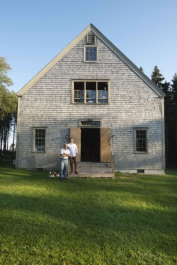
Greg Mort marks his beginning as a professional artist in 1977, about the same time he was invited to visit the state by the woman who introduced his work to the Washington, D.C. area. She had a farm near Tenants Harbor, and when Mort visited, he was smitten. Ten years later, he and his wife purchased Fieldstone Castle—an architecturally striking house literally made from fieldstones, completed in 1914—where they live through the summer months.
Returning each June is a ritual like a warm embrace from a friend.
“You look around to see what’s changed, and it’s usually nothing,” he says with a chuckle. “Maybe somebody painted their house.” That constancy is appealing, he says. So are the relationships he’s developed over the years with visitors to the barn workspace in what he terms “a 40-year time-lapse of friendship.”
The fieldstone house itself is another touchstone for his art and passion, for it was designed and built by Russell Porter (1871-1949), one of several in the area. Porter is renowned as the father of amateur astronomy, of which Mort is a passionate acolyte. He and his wife purchased Fieldstone Castle because of Mort’s interest in Porter, who also was an artist. Porter traveled above the Arctic Circle nine times, Mort notes.
He remembers a childhood friend who had a telescope. “We looked at the moon, and I just thought, ‘Wow!’ I followed the Soviet and U.S. space programs very carefully,” he says, and after establishing himself as an artist, he was able to meet some of the Apollo astronauts, including Neil Armstrong, who was presented with one of Mort’s works.
And he keeps an eye on the sky, despite it being increasingly difficult to see much.
“That’s one of the things that’s so precious about Maine—what the astronomers call ‘dark skies,’” he said. “Maine is way ahead of the curve in terms of making a change.”
He is active in the movement urging policy makers to consider using fewer street lights, and shading those that are used. He is a member of the International Dark Sky Association, and has donated art to the cause. Darkness, he said, is “actually the real state of affairs,” as the stars and moon emerge. “The curtain’s closed in the day time,” he adds. And 80 percent of the organisms in the world are nocturnal, further suggesting that night is worthy of the artist’s attention.
“The ocean puts a patina on everything.” An uninhabited island “looks as it has for thousands of years.”
—Greg Mort
Islands, like the night sky and its stars and moon, hold a degree of mystery. And they hold a universal appeal. “People understand and long for it,” Mort says, in part because these bodies of land surrounded by water “are a whole different entity.”

The Brothers, two small islands that become one at low tide, and Hupper Island, off Port Clyde, are favorite haunts.
The Brothers “has this lovely spruce tree on it. You can see it from the mainland.” The tree has become an icon, a touchstone of sorts to him, and more. “I guess it’s one of these little obsessions,” Mort admits, and it has figured in several paintings. “I’ve painted it from any number of angles.”
Mort’s work reflects all of the above—a love of the Maine coast and islands, an awe of larger forces and small emblems that shape and fill them, and the light that is found only on these shores.
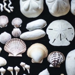
“I’m really intrigued with the relationships between things that are very big and things that are very small,” he explains, “the realms of large and small,” and indeed, his work includes both, like a piece that features a close-up view of shells on a beach as the Milky Way rises.
“The bulk of my work over the years has been watercolors.” He likes how colors can be layered, and yet retain an element of transparency, “letting it do what it wants to do, and yet control it.” And “the portability” of the medium allows him to be out in the natural world.
Mort’s work has been compared to that of 17th century Dutch painters like Vermeer, but he sees his work more in the tradition of the 19th and 20th century luminous painters, such as Frederick Church, George Bellows—who worked on Monhegan—and Rockwell Kent.
“They were naturalist painters,” he says, singling out Kent, who “was able to capture that understated beauty” of the natural world.
Mort’s work is, in some ways, minimalist, despite the scope, and it is precise. It reflects, he says, “a love of the craft of painting, this reverence for the object.”
The paintings seem like still-lifes, despite the galactic sources.
Greg’s son Jon Mort seems to have taken up his father’s passion for understanding the universe’s workings and gone even deeper. Like his father, the younger Mort’s work might be described as still lifes, but the elements he gathers and depicts speak of both the natural and human-made worlds.
“Heaven Trembling” includes sand dollar and periwinkle shells; a wooden frame; a model of a space capsule; and calipers, suggesting the artist is asking us to measure these elements. Mort says that, “In the end, the work is about storytelling.”
“Art is the true daughter of science.”
—Jon Mort
“It is the endless story of the tides,” he explains. “Watching them, it’s like you can feel the world turning. As a child, some of my most vivid memories are wading into a tidal pool, watching the minnows and crabs hiding.”
Another work combines shells, the bottom of a small, square tin, and stamps. The origins of each have personal connections, and, as arranged, are pleasing to the eye, but for Mort, they also speak of civil discourse, and the “aspirationally egalitarian society” in which we live. “The shells are from all over and facing in different directions,” he notes.
In addition to the still-lifes, Jon’s work includes the human figure and the landscape. “Maine holds a lifetime of inspiration,” he says.
“I credit this place for my deep appreciation for the natural world,” he continues. Inspiration is all around. “I’ll see a beautiful red squirrel, its copper colored coat, whales passing the boat on the way to Monhegan…” he says. The world here provides “an awfully wide window to look through.”
Observation runs deep in both science and art, Mort says, and seeing leads to reverence. “Art is the true daughter of science. You don’t seek to change anything—you only seek to comprehend.”
Tom Groening is editor of Island Journal.

John Marin’s Islands
John Marin’s Islands
American modernist painted these ‘tantalizingly beautiful’ sentinels
By Carl Little
In his poem “Sea-Change,” the late Philip Booth of Castine pays tribute to John Marin. First published in The New Yorker in 1956, the poem, written in Booth’s pared-down style, opens with the artist’s name then proceeds to accentuate his visceral connection to the Maine landscape:
Marin
saw how it feels:
the first raw shock
of Labrador current,
the surfacing gasp
at jut of rock,
bent sails, and wedged
trees.
In the next several lines, Booth expands on Marin’s powers of perception while evoking the calligraphic nature of his mark-making: “He wrote it:/Stonington, Small/Point, and Cape Split,/through a pane so/cracked by the lode-/star sun that he/swam back, blinded,/into himself to/sign the after-/image.”
The poet captures what art historians have come to call modernist energy, Marin’s ability to use an innovative visual language to represent the world, in this case, Maine:
“…mountains, ledged/towns (white as/Machias after/the hayrake rain),/sun-splintered/water and written/granite; dark light/unlike what you/ever saw…”
Toward the end of “Sea-Change,” Booth conjures a vision of one of Marin’s favorite subjects: “…until/inland, your own/eyes close and, out/of that sea-change,/islands rise thick…”
It’s a fitting image: from his first forays at Small Point in Phippsburg, through his sojourns in Stonington, and his final residence at Cape Split in South Addison way Downeast, Marin painted the archipelago, those isles that accent nearly every coastal horizon with their rocky edges and pointed firs. He was smitten.
The catalogue raisonné of Marin’s work, assembled by art historian Sheldon Reich and published in 1970, opens with several hundred thumbnails of New York City views, some European views, New Jersey landscapes, and images of Castorland in upstate New York. A resident of Cliffside, N.J., the artist had fanned out across the region—and abroad—to paint his impressions of places.
Then, in 1914, the first images of Maine appear, with a flourish: around 75 watercolors painted in the summer and fall near Marin’s rustic abode at the southern tip of Carrying Place Head off the coast of West Point in Phippsburg at the northern edge of Casco Bay. As Portland Press Herald art writer Bob Keyes recounted in a January 2017 article, Marin was drawn to the place by his friend Ernest Haskell (1876-1925), the well-known illustrator and printmaker who had taken up seasonal residence in Phippsburg in 1903.
Keyes notes that the 32-acre private island in the New Meadows River was accessible from the mainland for two hours at low tide, but that Marin preferred his rowboat (he would turn to a variety of boats, some motorized, to take him places during his Maine visits). He also mentions the painter’s hatred of mosquitoes, which are renowned for plaguing the area.
In the sixth edition of A Cruising Guide to the New England Coast, authors Roger Duncan and John Ware wrote that “the most voracious breed of mosquitoes ever developed has its headquarters” in Small Point Harbor, adding, “Only experienced hands can distinguish them from gulls.”
John Marin’s cabin on Carrying Place Head in Phippsburg, photographed by Portland Press Herald arts writer Bob Keyes. Keyes notes: “The island in the distance on the right is Wood Island. The photo also shows a bit of Little Wood Island on the left. There’s a small channel between them, which you can sort of see. As kids, we fished for flounder in that channel.”
Among Marin’s first Maine paintings was a view of Big Wood Island, which he could see from his “little shack.” It’s a quintessential action watercolor, the ledges and trees sketched in, lots of white paper lending light. The sea and sky are light blue washes, the island a small hump of pale green with a spine of black trees. It’s the kind of painting that led critic Alexander Brook to remark on the “extreme velocity” of Marin’s vision.
“Each picture,” he observed, “gives the spectator an eyeful in the swiftest sense of the word, what one might with the good fortune see in the twinkling of an eye.”
Marin came back to Phippsburg in 1915, continuing his exploration of the area. In a new Maine bicentennial-inspired book, At First Light: Two Centuries of Maine Artists, Their Homes and Studios, Bowdoin College Museum co-director Frank Goodyear relates how the painter used an advance from his New York dealer, the visionary photographer Alfred Stieglitz, to purchase a small island near West Point. In an act of proprietorship, he named it Marin Island. Although the diminutive retreat would prove inhospitable to Marin and his family, he painted it on a number of occasions.
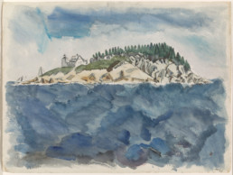
John Marin
Deer Isle Series: Mark Island Lighthouse
watercolor, 1928
16½ by 21¾ inches
Indeed, even after Marin moved north and east, first to Stonington and then to Cape Split in South Addison, he would return to his original Maine home, producing numerous watercolors of the area. He painted views of Morse Mountain, Popham Beach, and Ragged Island, which would become poet Edna St. Vincent Millay’s summer retreat in the 1930s and 1940s.
In a letter to Haskell’s son in March 1943 Marin described going “quite often” to Ragged “either in your Father’s Swampscott or outboard power boat.” He recalled how they both loved the island’s “bold wildness—then we’d get busy—he with his [etching] needle—I with my brush—and we’d never disturb one another and we’d get home—well—when we got home.”
In 1919, Marin and his family—his wife Marie and son John Jr.—spent their first summer in Stonington. If West Point had whetted his passion for islands, this new setting sent him over the moon.
“Some of the views with innumerable islands are bully,” he wrote Stieglitz on June 17 not long after arriving. By July 1 he had come to appreciate more fully the local bounty. “It seems that Old Man God when he made this part of the Earth just took a shovel full of islands and let them drop.”
Back in Stonington the following summer and fall (he stayed till early November), Marin reports watching the steamboats Bandwell and Morse coming and going. In August 1921, he recounts a boat ride to Isle au Haut and a fishing trip with Eddie Gross. “We got about 150 pounds of cod,” he tells Stieglitz. “I kept two. Eddie Gross can sell the rest, though it wouldn’t go bad to stop painting and sell fish.”
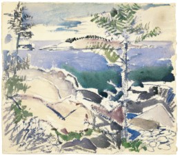
John Marin
Big Wood Island
opaque and transparent watercolor over graphite on wove paper, 1914
14¼ by 163/8 inches
In a Sept. 11, 1921, letter, Marin admits, “This Stonington is a cussed place, but if someone were to tell me I couldn’t come back here next year I’d be mad clear through.”
As was his MO, Marin took every chance to visit islands. On Aug. 13, 1922, he recounted a trip to a new island:
There is an island off here [Stonington] called Bold Island. I had never set foot on it before. Yesterday I did, and it’s rightly named. It’s Bold and that’s its name. It rises up in every direction and at the summit there are huge ledges of white granite and you sit down and look out over the sea and island and there is Scragg Island and Devil’s Island and Camp Island and many, many others and each has its special fascination. And then there is that wonderful high [Crotch Island] quarry with its sharp cutting forms. Yes, thank the Lord, at last I have an engine that has power and works.
Over the years Marin made a number of paintings of the Mark Island Light at the western entrance to the Deer Isle Thorofare. In the Portland Museum of Art’s watercolor from 1928, the square brick light tower and the lightkeeper’s house (which burned down in 1958) are sketched in along with the top of the boat house and a schooner sailing past.
Marin felt increasingly at home in his seasonal quarters.
“They are beginning to take me up into their bosoms here down East—they no longer class me in with the rusticators they being those who rusticate during the warm summer months—the white flannel nikers [knickers] brigade,” he proudly told Stieglitz in a Sept. 24, 1924, missive. “This place has gotten me by the nape of the neck,” he writes two years later, on Sept. 11, 1926. “Once I get here I forget other places, which is a failing I have that I am perfectly aware of.”
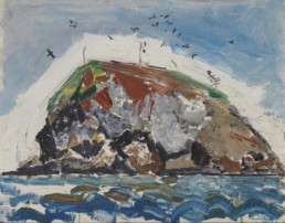
John Marin
The Ladle
oil on canvas, 1934
22 by 28 inches
For the most part Marin painted en plein air. In their expressionist verve, his paintings matched the dynamics of the landscape before him: the movements of sea, the twisted beauty of wind-blown trees, and the gnarly islands. He described the process in a letter from Small Point dated July 20, 1931:
Out door painting as such is just a Job—to get down what’s ahead of you—water you paint the way water moves—Rocks and soil you paint the way they were worked for their formation—Trees you paint the way trees grow. If you are more or less successful these paintings will look pretty well indoors for they have a certain rugged strength which will carry them off in a room—though they seemingly bear no relationship to the room.
In 1933, Marin took his family further Downeast, renting a house at Cape Split in South Addison. Once more, he found himself surrounded by islands.
“This place—little cottage—has a swell outlook over the waters—with the islands scattered about,” he reported to Stieglitz (Sept. 3, 1933). In another letter, to artist friend Emil Zoler (Sept. 14, 1933), Marin noted the profusion: “There are islands here—then some more islands—then a few thrown in for good measure.”
Marin would eventually paint many of them, including Jordan’s Delight, Outer Sand Island, Norton’s Island, Flint Island, and Sheep Island. He also went on painting excursions to Quoddy Head, Machias, Schoodic, and Mount Desert Island, and painted Tunk Mountain and Katahdin. As in Stonington, he made close friends with his neighbors, one of whom, Susie Thompson, would become a formidable artist-disciple.
At Cape Split, Marin began painting in oil more. As he wrote to Stieglitz on July 30, 1933, “I know that when I quit this Expression in Water Colors—the which I am now playing with—and get to the dignified—the high muck a muck medium Oils—I know that my clothes ‘l’ a’gin to have paint spots on em and that my wife ‘l’ a’gin to say things.”
Marin’s oils are as dynamic as his watercolors. Witness his rendering of The Ladle, a rocky eminence with high cliffs near the entrance to Cape Split harbor, which, looked at from one angle, resembles a long-handled spoon with a deep bowl set flat against the sea. Marin transforms the homely landmark into a kind of crazy quilt, the paint applied with gusto. The sky is alive with a swarm of seabirds while the ocean seems to leap across the bottom of the painting.
When Marin couldn’t get to Maine the summer of 1943, he sent a special request to his friend, the writer Herbert Seligmann: “Send down two bottles each hermetically sealed—one containing a Sample of that real old North Atlantic and too a sample of that genuine Cape Split salty ozone I think it will extend my period on this Shaky Crust we call the Earth.”
Sometime in the 1940s Marin began signing his letters with variations of “Yer ancient Mariner.” In the last letter in The Selected Writings of John Marin (1949) dated Aug. 26, 1948, and addressed to the book’s editor, photographer Dorothy Norman, the painter speaks of the islands, which remain “tantalizingly beautiful” and “work on” him. “They good company—I—I hope not too bad a—Subject.”
Marin suffered a stroke soon after arriving at Cape Split in 1953. Seven weeks later, on Oct. 2, he died just shy of his 82nd birthday. He is buried in Cliffside Park, near his home in New Jersey.
While Sheldon Reich stated at the end of the catalogue raisonné that “Marin was the beginning of no school of painting,” he inspired generations of painters to emulate his dynamic approach to painting. Whether in Terry Hilt’s dazzling watercolors of Monhegan or an Eric Hopkins North Haven sunset, the master’s modernist aesthetic lives on. And so do the islands Marin painted, those “tantalizingly beautiful” sentinels in the sea that kept good company and inspired some of his most memorable paintings.
Philip Booth ends his homage to the artist by highlighting the power of his:
riptide
paint, that, flooding,
tugs at your vitals
and is more Maine
than Maine.
Carl Little’s book Mary Alice Treworgy: A Maine Painter is forthcoming from Marshall Wilkes. His poetry has been featured in Maine Sunday Telegram’s “Deep Water” series and “Poems from Here” on Maine Public Radio and appears in Local News: Poetry about Small Towns (2019). He lives and writes on Mount Desert Island.
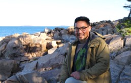
Zain Padamsee Found Himself on Frenchboro
Zain Padamsee Found Himself on Frenchboro
Former Island Fellow recalls being not quite a Mainer, not quite an islander
Story and photos by Scott Sell
On the top deck of the Henry Lee on his way to live for at least a year on the island of Frenchboro, Zain Padamsee looked longingly back at the mainland fading from view, wondering if he had made a huge mistake. This is it, he thought. No escaping, at least until the next ferry back to Bass Harbor. That would be three days later.
It was September 2015 and Padamsee was on his way to being Frenchboro’s new Island Fellow, tasked with working on the island’s comprehensive plan and other town projects. The community had planned a potluck that evening in his honor and there were a few hours to kill beforehand. After dumping his duffel bags at the parsonage—his new home—he decided to take a walk through the woods to clear his head and shake the anxiety of having to make a good impression. Not to mention suddenly living more than eight miles out to sea.
It was a warm fall day, and he made his way to Deep Cove at the southern end of the island. Taking out his phone to snap a photo, he saw that he had less than 30 minutes to get back in time for the potluck. He also realized he had gotten turned around and lost the trail. Panicked, he started running in the direction he thought he should be going, but found himself heading deeper into the thick woods with no trail in sight. At last, he burst out onto the high road, right behind the parsonage.
Drenched in sweat and with no time to change his clothes, he anxiously hustled over to the community building where he was surprised to find only one or two people gathered, setting up tables and chairs. He wasn’t late at all. But he still caught strange looks. His shirt was soaked through and he couldn’t keep beads of sweat from rolling down his face. Months later, when people were more comfortable with him, they told him they were convinced he was covered in sweat from being so nervous. Which, of course, was only partially true.
“I’m an odd dude,” he says, laughing at himself. “Being on Frenchboro allowed me to accept that part of me. I found myself early on trying to pretend I was someone I wasn’t. I learned that, on an island, people are able to figure out who you really are pretty damn quick.”
Now, nearly five years later—after two years of his fellowship and another two staying on the island to be a sternman on Zach Lunt’s lobster boat—Padamsee has come to see these people as his family, the island his home, and a large part of his identity wrapped up in this place.
~
It was Nov. 17, 1990. Padamsee’s parents were attending a glitter ball at the Australian Embassy in Dhaka, Bangladesh when his mother’s water broke. As they rushed out into the streets, they saw cars on fire and a bus being turned on its side. President Ershad’s government was in the midst of being overthrown. Zain was born a few hours later, covered in glitter.
His father—a Bangladeshi national—and his mother—an Idaho native—divorced shortly after. Padamsee and his mom moved to Ithaca, N.Y. where she got her doctorate in adult education and community development from Cornell University. While finishing her thesis, she started looking for teaching jobs in places that were good to raise kids and several positions were in Maine. Padamsee was five years old and remembers visiting Old Orchard Beach in between job interviews. It was the first time he saw the Atlantic Ocean.
They settled in Gorham where she taught at the University of Southern Maine for ten years. When he was in middle school, his mother felt a calling to be a preacher and she went back to school to get a master’s degree in theology. Her first job as a full-time minister was at the Methodist church on Peaks Island, giving Padamsee his first taste of island life.
“It was a completely new experience,” he remembers. “I went from being just another kid at Gorham High to being the preacher’s son on an island where everyone knows everyone.”
For two years, he crossed the bay with commuters on the 6:15 a.m. ferry to make classes at Casco Bay High School. During his summer breaks from American University and then University of Maine at Farmington, he scooped ice cream at Down Front, near the ferry landing. He and his mom were welcomed into the community, but still, he felt like he was never really able to let his hair down, always needing to be on his best behavior in living under the microscope. It wasn’t until he got to Frenchboro that he understood what living on a remote island truly could be.
“Frenchboro made me believe in love at first sight,” he says. “I instantly fell in love with its beauty.”
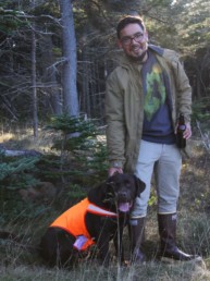
Zain and Henry on Frenchboro’s Eastern Beach.
~
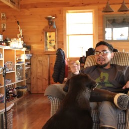
In front of a roaring fire and slowly sipping a “Frenchboro Sunset”—vodka, cranberry juice, and tropical fruit juice, a cocktail of his own making that’s now beloved on the island—Padamsee remarks that the fading sun outside is creating colors in the sky similar to those in his glass.
Henry, his chocolate lab, sniffs around the coffee table, hoping to find something that’s dropped on the floor. Padamsee takes a bite of a chunk of cheese and gives Henry the other half.
“There you go, you big fool,” he says, scratching behind his ears. The two are inseparable: together on long walks in the woods, drives in the truck around the island, in and out of houses where Henry can scrap with other dogs. After Padamsee has been away at work on the water, Henry is excited to see him. One afternoon, the dog saw him walking toward the house and sprinted down the road to jump up and give him a kiss, but ended up giving him a bloody lip instead.
“It’s worth it. He’s the perfect pup. And having him around has helped me when times have been tough.”
It’s been hard to be here over this last year, Padamsee admits. The previous winter felt longer and more lonely. Whenever he doesn’t have to be on the island to fish, he’s on the mainland trying to make plans for what comes next.
He finishes his drink and stands, looking out through the bay windows as the sun disappears completely, the sky turning a brilliant orange.
“Let’s go outside and catch that sunset,” he says.
~
Padamsee had a good sense of the work he’d be doing as the Island Fellow, but didn’t know how he’d fit in with the roughly 50 people living on the island.
“I was already from away and I look like I’m from away,” he says. “I’ve grown up with that as a mixed race kid, especially in a state that’s predominantly white.”
He made a point of being neutral and professional and as much of a Mainer as possible. But he felt he was seen as the Island Institute Fellow and that was all. He spent the first few months figuring out the interpersonal aspects of living on the island and tried to meet everyone. And he found a clever way to do so, home brewing IPAs and brown ales in the kitchen of the parsonage—he called them “Holy Brews”—and hand delivering fresh batches. It would inevitably lead to conversations on front porches and at kitchen tables. He was touched to learn, later on, that many of the teetotalers on the island were the same people who graciously accepted bottles of his beer.
Working on the comprehensive plan also helped with his integration into the community. With municipal planning in most towns, you can get away with surveying 75 percent of the population. But on Frenchboro, with its 30-something year-round residents, Padamsee felt he would be doing the town a disservice by not getting input from everyone. That meant knocking on every door and talking to people about the plan any chance he got. He made the argument that the plan was the town’s defense against state mandates and potential development on the island.
“I was the annoying guy with the surveys,” he says. “I told everybody, ‘I’m going to keep bugging you until these are all done. We’re going to learn about this process together.’ That was a big theme of my time here: figuring it out on the fly.”
~
Padamsee stands sleepily against the wall of Zach Lunt’s kitchen, layered in sweatshirts and jackets, cradling a steaming cup of coffee. Lunt listens to what his young daughter wants for breakfast with one ear and the crackle of the VHF radio with other. He’s waiting to see how other fishermen are faring on the water before they decide to go out this morning. It’s not stormy, exactly, but with a strong easterly wind, it’s shaping up to be pretty rough seas.
The two men have been going hard lately, lots of long days as they start to take some traps out of the water in addition to fishing. A couple of years ago when he first started with Lunt, and was 70 pounds heavier, it would have been difficult to keep up with the workload. But in keeping with how his fellowship had gone, his being asked to be Lunt’s sternman was another opportunity to learn on the go.
“I couldn’t tie a knot. I didn’t know how to measure a lobster. I knew nothing,” he says. “People had every right to think I wasn’t cut out for it. Zach was one of the only people who believed I could do it.”
Hard work wasn’t something Padamsee was afraid of: he knew he could work his ass off. There was another problem.
“Holy smokes, did you get seasick!” Lunt says, belly laughing.
“If I had to deal with a day like this when I first started,” Padamsee says, “I would have been green before we left the mooring.”
For the first few months on the boat, he would get sick almost every day. He tried using Dramamine, ginger gum and candies, Sea Bands, anything people suggested for nausea. Nothing seemed to work. But Lunt assured him his body would eventually get used to it.
“People saw me get up, go out, puke all day, go back home, wake up, and do it again day after day. And I think after a couple months when they saw I was sticking with it, it gave me some credibility.”
He worked some of the hardest days of his life last winter, spending hours stacking ice-coated traps on the slippery deck of F/V Joann’s Angels, icicles forming on his beard. At one point, after rocking and rolling all day, the boat’s bow dipped deep into the trough of the waves before a wall of water overcame them, somehow not taking any traps with it.
“Fishing changes a person, physically and mentally,” he says. “It will push you to do things you might not have known that you could do before. You learn that you can work a grueling day and get up to do it again and again. You develop a trust in the boat and the captain, that no matter the circumstances they will make sure that you make it home safe.”
The wind pushes against the kitchen windows, rattling the panes.
“I can’t say I’m happy to be out here,” a voice finally says over the VHF radio.
“Nope, me neither,” says another. “I’m headin’ in now.”
“Well,” Lunt says, pouring himself another cup of coffee, “might be a good day to stay warm.”
~
As his fellowship neared its end, Padamsee realized he’d be taking on a new challenge: becoming a full-time islander. Without plans on the mainland, he decided to stay on the island to continue working with Lunt. But it took several months to shake his role as a Fellow. His personality didn’t change, but people started to hear opinions from him, things he might not have said when he was a Fellow. And sometimes they didn’t like what they heard.
“I told them, ‘I’m living here as a resident, not as an employee for the Island Institute. I’m speaking for myself now.’ It was difficult to do after two years of having the safety net of the organization.”
But islanders knew him well by this point and saw promise in his leadership, asking him to serve on the select board, which he did for a full year, from June 2018 to June 2019.
“People trusted me enough to want me helping with important decisions,” he says. “That felt good. I knew enough from my fellowship to carry on something resembling civic responsibility.”
With fishing off the table for the day, Lunt and Padamsee walk across the low road and into Lunt’s trap shop to see what they can work on inside. The shop—big enough to do repairs on traps and paint buoys and not much else—was one of the many places Padamsee called home over the years. As is the case on most year-round islands—where work is available but housing is scarce—Frenchboro has few places for sternmen or other young people to live. After his fellowship ended, he no longer had a permanent home and spent the last two years living in five different places on the island, packing up his things into duffel bags every few months.
His bed in the trap shop was an army cot cozied up next to a space heater. He stayed here for three nights until his friends Danny Saxby and Sarah Brake—a fisherman and his Fellowship advisor—told him he was nuts and invited him to live with them. He quickly got absorbed into their family unit, a loving roommate to their two young sons, Arlo and Bennett. He’s perfectly comfortable living here: he wears his boxer shorts around the house and on mornings when Saxby has already left to go fishing and Brake is still sleeping, Padamsee will often cook breakfast for the boys, making them egg sandwiches just the way they like them.
“It will be really cool to come back to visit in a year, in five years, and see how the family is doing,” he says. “The work they’ve done on the house, how the boys have grown. I’m sure there will be a million things that are different about the island by the time I come back.”
~
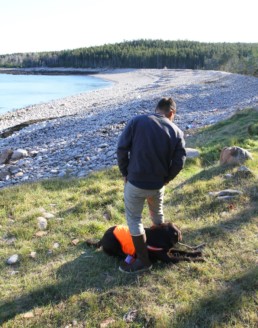
On a bright November morning, Padamsee walks the trail to Northeast Point while Henry happily bounds over the mossy rises of rock and through the pines. He adjusts his glasses, looks out across the bay towards Mount Desert Island, and shivers a little. He lets out a sigh. Henry races back through the trees and nearly onto his lap.
“What’d you find?” he asks and the dog licks his hands.
In a few weeks, Padamsee and Henry will leave the island for good. They’ll move to Biddeford, where the rent is reasonable and he has friends living nearby. After living in camps and uninsulated houses on the island—with iffy heating and sometimes non-existent ways of cooking food— he’s excited about buying fresh vegetables. He’ll be able to go to the gym, sit at a coffee shop. He knows he’ll enjoy the convenience, more of a social life, his days being his own.
He’s quick to admit that he’s unsure what the next chapter is, but he’s certain his time on Frenchboro prepared him for whatever it might be.
“I think I’ll miss the quiet nights here most,” he says. “I have way too many quiet nights right now. But I know I’ll miss it as soon as I leave.”
Scott Sell is a freelance filmmaker and writer, focusing primarily on documentary storytelling. He served as an Island Fellow on Frenchboro from 2006 to 2008 and was the Island Institute’s media specialist for several years. He lives in Rockland with his wife, the artist Alexis Iammarino, with whom he runs Little Legs Projects, a multimedia production company.
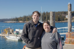
Stonington Siblings Modernize Lobster Business
Stonington Siblings Modernize Lobster Business
Travis and Christina Fifield returned home to run their family business
By Laurie Schreiber
In the early 2000s, Travis Fifield left his hometown of Stonington for college and then a lucrative career with General Electric’s power plant construction division in Windsor, Conn. Funny thing: He chose to live and work within a day’s driving distance of Stonington because a little voice in his head told him he would want to wend his way back home one day.
What he didn’t know is that he would end up taking over his family’s multi-generation wholesale lobster business, Fifield Lobster Co., and recruiting his sister Christina Fifield to partner with him.
“When I was in college looking for a job in New England, I figured that, in the future, I’d probably want to work my way back home,” he says. “Southern New England was a good hopping point. It was like, ‘Dad, I’m moving home and I’m going to work in the business.’”
He laughs.
“A little while later it was, ‘Christina is, too.’”
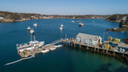
Fifield Lobster Company sits on the southern edge of Burnt Cove in West Stonington.
Finding Fifield Lobster is a bit of a trick, but a pleasant one. It involves winding through the narrow streets of this tiny island community, in view of clam flats, small inns and eateries, wharfs stacked with lobster traps, and fishing boats.
A visitor might be tempted to look for a roadside business sign. No such luck.
Along Route 15, which traverses the downtown, the thing to do is to keep going and going, keeping the ocean within view, until a street sign for Fifield Point Road appears, leading to a small, double-pointed peninsula that resembles a lobster claw.
Seconds later, stacks of traps, a couple of wharfs, and a bait shed signal destination reached. Still no company shingle, but that might not be necessary in a community of 1,000 year-round residents, where everybody knows each other.
More importantly, from the business standpoint, the fishermen know the Fifield family.
“The guys who sell here have been selling here for generations,” says Travis. “One of the families that sells to us, their grandfather sold to our grandfather, their father sold to our father, and now they’re selling to us.”
“Relationships and loyalty are big in this industry,” says Christina.
Their great-great-grandfather, Tilden, bought lobsters here through the 1940s and also built the wharf. Their grandfather Willie took over, followed by their father, Wallace, who goes by the name Wally.
Travis and Christina, now in their 30s, didn’t expect to carry on that tradition. In fact, they and their two other siblings didn’t really know what would happen to the company when their father stopped working. The kids grew up “business adjacent,” as Travis says.
“He worked very, very hard and was very, very good at what he did, so he tended to do everything,” he says. “We kicked around on the wharf but weren’t really involved.”
They remember the pleasures of growing up by the water, hopping into the skiff to noodle around the cove, setting traps on their student lobster licenses. Their mother Debbie, the bookkeeper until 2000, kept an eye on them from a shorefront shack that served as the business office.
Travis went to High Point University in High Point, North Carolina, to study international business and Spanish. While there, he worked for a freight forwarder that specialized in furniture imports, organizing transportation logistics for getting containers from factories to their destinations.
He was fascinated by the intricacies of international logistics. After graduation, he worked the next decade for G.E., handling components for its global natural gas business.
Travis and Christina share responsibilities and skillsets, whether it’s transporting bait or entering data.
“I liked the planes, trains, and trucks part of it,” he says. “My job was figuring out how to get large, heavy stuff from point A to point B.”
For example, G.E. manufactures gas turbines.
“We’d figure out how to get them from the factory floor, coordinate the cranes, barges, and ships to bring them downriver to a break-bulk vessel, organize transit to whatever country they’re going to, organize and clear customs, then do it in reverse on the opposite side.”
Christina had also gone off, enrolling at Thomas College in Waterville for a degree in communications. She returned to Stonington to raise her daughter, now nine, got a couple of restaurant jobs, then started working with the Maine Center for Coastal Fisheries to help the Stonington nonprofit coordinate its Eastern Maine Skippers Program.
Wally kept up a nonstop pace. The siblings remember him spending countless hours working, even sleeping on the dock to sell bait and fuel to fishermen coming in before dawn. He’d shovel bait by pitchfork and haul fish totes up from the boats by block-and-tackle.
“We bought him a new bait shovel every Christmas,” says Christina.
“My grandparents used to tell him, ‘If you don’t slow down, you’re going to blow a tube,’” says Travis.
Back Home
Several years ago, two things happened. Reaching his 70s, Wally realized he couldn’t go on forever. And Travis got tired of the corporate culture.
“I was using all my vacations to come back here,” he says. “Every time I’d go back to Massachusetts, I’d think, ‘Oh, no.’”
So he returned home, eventually recruited Christina, and the family devised a plan to transfer equity in the business. Although there was a huge learning curve, Travis’s training in logistics kicked in, plus his father, fishermen, and suppliers were glad to see the next generation stepping in and were eager to explain how things worked.
Wally remains involved in the business, but the siblings are modernizing. Travis is working on permit applications to expand one of the wharfs to accommodate more and larger boats. The plan includes hydraulic hoists—a boon over their father’s backbreaking tasks.
Rising sea levels also have prompted them to seek permits to raise the dock, which includes the bait shed, by at least a foot.
“Some of the high tides we’ve had, the water comes up over our parking lot and onto the floor of the bait shed,” said Christina. “We’re trying get ahead of that.”
In response to quota reductions in the herring fishery, they’ve diversified bait varieties to include pogies, rockfish, haddock, herring, tuna, pig hide, and more. The way bait comes in has changed, too.
“I remember boats coming in here pretty often to unload,” says Travis. “Or dump trucks would pull up and offload hand cuttings from the sardine factories.”
Now it comes in massive, 2,000-pound containers, much of it frozen and from overseas. A cooler below the office can hold the bait for a short time, but another goal is to build a freezer so they can stock up.
They’ve added seasonal workers and organized shift schedules to avoid the hundred-hour weeks of their father’s day.
“My husband’s a lobsterman, I work as a lobster dealer, I help out at a fisheries nonprofit. My entire life revolves around it.”
—Christina Fifield
That’s all the more necessary given the growing fishery. Years ago, the wharf served 10 to 15 fishermen. Today, 35 boats bring in over 1 million pounds of lobster.
Christina is building the marketing. For the first time, there’s a company logo and letterhead stationery.
“The bar was pretty low,” Travis says with a laugh.
Also new? Data tracking.
“We track crates in and out, where they go and how many,” says Christina. “We track bait and fuel. We’ve updated all of our technology. We became a corporation.”
In 2018, Travis became a selectman. Like much of coastal Maine, the town is grappling with affordable housing, as more homes are converted to lucrative seasonal and vacation rentals. The local schools are dealing with rising per-pupil costs and declining infrastructure. Then there’s the interdependence between the lobster fishery and the larger community. Stonington is Maine’s largest lobster port.
“I think there’s worry about long-term viability, as a smaller, more remote town,” says Travis. “Without the lobster fishery, I don’t know what a lot of people would do.”
“A lot of us rely on the ocean,” says Christina. “My husband’s a lobsterman, I work as a lobster dealer, I help out at a fisheries nonprofit. My entire life revolves around it. When the industry ebbs and flows, it hits everybody.”
The Fifields have rapport with Stonington’s fishing community. Some of the fishermen have been associated with Fifield Lobster Company for many years.
Yet, having been out in the bigger world, that small, remote town is just right. Christina and her family live in neighboring Little Deer Isle. Travis and his partner, Jake, live in the house he and his siblings grew up in, across the street from the business.
“We both want things to go well,” says Christina. “We want Dad to be proud. We want the fishermen to notice that we’re taking over but so it’s seamless, so we’re not changing too much but making lives easier.”
And the community’s fate also is important.
“I think there’s a push from people who move here to want to make this place similar to the place they’ve come from,” Travis says. “I really want to keep this place the way it is.”
In addition to writing for Island Journal, The Working Waterfront, and other Maine publications, Laurie Schreiber is a Mainebiz staff writer and has covered topics in Maine for more than 30 years.
Southwest Harbor Works to Navigate Change
Southwest Harbor Works to Navigate Change
Tourism is important, but working waterfront access gets prioritized over cruise ships
story By Griffin Pollock
photos by jack sullivan
Many in Southwest Harbor remember when tourists were rare in town. The small village on the south side of Mount Desert Island has long been shielded from the forces of large scale tourism, with Somes Sound and much of Acadia National Park between it and the visitor mecca that is Bar Harbor.
But as tourists continue to visit Bar Harbor and other areas in increasing numbers, so does the spillover of people into what’s known as the “quiet side” of MDI. Those searching for a more isolated hike in the park, or boaters looking for less busy stretches of water, have been making their way to Southwest Harbor.
In the late summer of 2017, the pressure came to a head. The cruise ship Pearl Mist sought to schedule a call at port, and in response, residents voted unanimously to place a temporary moratorium on such vessels entering the harbor, a restriction that continues today.
Jim Colquhoun, chairman of the Southwest Harbor Shellfish Committee, said the unanimity came from a community gut feeling.
“We voted based off our gut instinct,” he said. “Which for most of us was just, ‘Well, we’re inundated now, we don’t need a cruise ship out there.’”
And it’s not just more tourists on the sidewalks that bother some residents. Cruise ships require a large piece of waterfront to be able to load and unload passengers during their stay. This can impede fishermen and others who need access to the water.
Fishermen are known to object to those operating larger, recreational boats, and with good reason. Beth Gronros, manager of the Hamilton Marine Store in Southwest Harbor, notes that while lobstermen are on friendly terms with small boaters, they can lose up to $120 for each trap that might be cut by a cruise ship propeller, an investment that adds up if it occurs multiple times per season.
The 180-day moratorium on cruise ships has expired, and while no cruise ships, including the Pearl Mist, have requested to dock at Southwest Harbor since, the problem remains fresh in the town’s imagination.
And it’s not just fishermen who rely on the water.
“Businesses have been able to prosper, to grow and prosper, because they have access to the ocean,” Colquhoun said. “You start to add it up—and we did for the harbor committee—you’re talking several dozen year-round, good jobs that depend on having access to the ocean.”
“You’re talking several dozen year-round, good jobs that depend on having access to the ocean.”
—Jim Colquhoun
Other changes loom in the fishing industry.
As lobster has become more profitable in recent years, the relationship fishermen have with the ocean has changed. John Stanley, an older lobsterman in the community, recounts how those of his age could find their way in the fog with a compass, feel the ground with poles and lead weights, and navigate through the Cranberry Isles in the middle of the night. Those skills have not been passed down to the younger generation, Stanley says, but it’s not their fault.
“Kids are exposed to so much more now,” he said, and while they’ve found success, he’s concerned about the lack of diversity in the fishing industry, which could leave some high and dry if the lobsters decline.
Older fishermen remember a far more diverse fishing economy. While the collapse of cod is a memorable and dramatic example, there are many more species that are no longer harvested.
In comparison with the multi-species fishing of the past, lobster has risen to be the most heavily fished species in the Gulf of Maine. John Stanley notes that fishermen “catch more and more in a day than we used to catch in a year. And now these guys they’re getting 2,000 a day.”
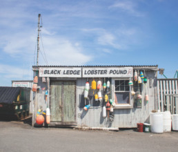
Lobster businesses like Black Ledge Ledge Lobster Pound exist—sometimes literally—at the intersection between the tourism industry and the working waterfront.
Still, amidst these changes in the fishing industry, there’s a strong connection between the past and the present. Jim Colquhoun laughs as he recalls the story of how a young fisherman’s grandfather was so pleased at the idea of his grandson entering into the industry that he went out and bought him his first hip waders.
In the tourism industry as well, many Southwest Harbor residents want to retain their small, relaxed town atmosphere and not to exclude tourists, but to attract a specific set of visitors who want to absorb the sights and feeling of a small, traditional Maine town.
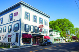
Southwest Harbor’s small downtown accommodates tourists with its inns, restaurants, galleries, and cafes.
Are the changes good or bad?
Fishermen are making good money. Tourists are bringing their business to the community, at the potential cost of a town identity and local quality of life. On a coast that is constantly changing, in the industries that are constantly changing, Southwest Harbor’s story is one that can be found along the entire coast. While these changes are not ones that can be wished away by a singular, temporary ordinance, they can be addressed through the collaboration of conscientious community members.
Luckily, Maine’s tradition of community engagement shows no signs of slowing down. Southwest Harbor carries on with this tradition, with residents committed to keeping their town intact. Or at least recognizable.
Griffin Pollock is a 2019 graduate of College of the Atlantic in Bar Harbor. This story is funded in part by the Fund for Maine Islands.
Islesford’s Calendar Girls Loyal to ‘Dip of the Month Club’
Islesford’s Calendar Girls Loyal to ‘Dip of the Month Club’
Women commit to a jump in the ocean—each month of the year
story and photos By Jack Sullivan
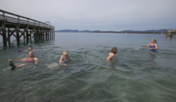
Istood on the shore of Islesford in early March—five women trying to coax me into the wintry Atlantic water—when a famous quote entered my mind:
“I realize more and more what it takes to be a really good photographer. You go in over your head, not just up to your neck.”
These words belong to Dorothea Lange, legendary photo-journalist and a personal hero of mine. I believe she meant this in a metaphoric sense, but when I found myself documenting the escapades of Islesford’s famous Dip of the Month Club, this quote adopted a literal interpretation.
The Dip of the Month Club has been in action for nearly 20 years, and its mission is simple: take a dip in the ocean once a month, every month. Yes, even in the winter. The club has a rotating cast of dippers—though four women, now in their 60s, make up the original ensemble: Stefanie Alley, the only lobsterwoman at the Cranberry Isles Fishermen’s Co-op; Joy Sprague, the island’s energetic postmistress; Barb Fernald, a talented jeweler and writer; and Cindy Thomas, Islesford’s affable librarian. The newest member, Mary Schuch, 30, was also in attendance for March’s chilly immersion with a commendable showing of endurance as she clocked in more time in the water than anyone else.
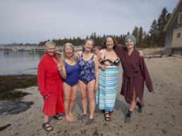
Left to right: Stefanie Alley, Joy Sprague, Barb Fernald, Cindy Thomas, Mary Schuch
The club’s origin story is one of impulse. A heatwave in October 2002 inspired the group of women to cool off at the aptly named Sand Beach after a hard day’s work. Everyone who swam on that fateful October afternoon felt so invigorated that one of them even tossed out the suggestion, “Imagine if we did this again next month…”
And here they were, 209 months later, getting ready to complete the ritual again. The dip was on for 1 p.m., and the conditions were ideal. Several variables can interrupt a dip—especially the winter ones. Of course, there’s everyone’s personal schedule to take into account, but they must also consider the tides, the wind, the height of the waves, and even the density of seaweed.
This particular Monday in early March was slated to be calm and unseasonably warm, a perfect opportunity to get the dip done early in the month.
While the air temperature on the day of my visit was in the 50s, the ocean temperature was lagging behind, coming in just shy of 37 degrees. In fact, NOAA reports that the ocean is at its coldest in March (and warmest in September).
On the ferry ride over, I chatted with a few residents of neighboring Great Cranberry Island. When I mentioned the Dip of the Month Club, one of the islanders voiced concern about immune systems being compromised by the cold temperatures. While such concerns are well intended, the Dip of the Month Club is more preoccupied with the feelings of refreshment, vitality, and comradery that its members associate with their monthly ritual.
At about the appointed hour, we disembarked from Barb’s car—deemed “The Dip Mobile” on days like this—and scrambled down onto Sand Beach. The dippers splayed out their towels and hot water bottles and stripped down to their one-piece suits. It was game time.
They didn’t waste any time either. It’s clear that the easiest way to go about this is to get it all over with as quickly as possible. Following a collective, “One… two… three…” came a series of splashes as the dippers sprinted headlong into the cold water. There was one resounding “WHOOO” followed by a cacophony of hoots and hollers as each of the dippers assumed the required position (a dipper must be up to one’s neck and floating horizontally in order to have officially participated in a “dip of the month”). Once everyone was back on the shore, it took all of 30 seconds for the suggestion to arise, “Are we going back in?”
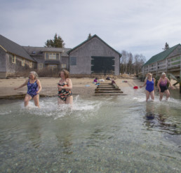
It wasn’t just a double-dip, either. The warm air temperature inspired a triple-dip—an unprecedented occasion for the month of March. It was right before this third dip that the club decided I had taken enough photos. The women thought it was time for me to immerse myself (pun definitely intended) and learn what it meant to be a member of the Dip of The Month Club.
My list of excuses was thin. I already had my trunks on, having waded in up to my knees on the previous two dips to photograph from an optimal position. They had brought an extra towel. And, in all honesty, I’ll do anything just to say I did it.
Those hoots and hollers that could be heard anywhere on the island were not melodramatic at all. In fact, many of them belonged to me. With Dorothea Lange’s words on my mind,
I committed fully. Though it’s not a requisite for becoming an honorary member of the club, I went in over my head.
As I had every square inch of my body submerged in the 36.9 degree salt water, I thought to myself, “Man, these women are crazy.” I lurched out of the water like a humpback whale eager to beach itself, and another thought occurred to me: “It takes one to know one.”
Jack Sullivan is a multimedia storyteller with the Island Institute.
Fishing, Fowling, and Navigation
Fishing, Fowling, and Navigation
How a colonial ordinance shaped a coastline
By Rebecca Pritchard
In this part of the world, the tide comes in and the tide goes out twice a day. Each time the tide goes out, it exposes cobbles, mudflats, tidepools, rockweed, and cool wet sand.
Who owns this intertidal zone depends on the law of the land on which the tide ebbs and flows. In New Hampshire, you could walk anywhere below the high tide line along the 238 miles of coastline and never encounter private property.
Like most coastal states, the intertidal zone on the New Hampshire coast is in the public trust, like the ocean itself. In other words, the land between high and low tides is owned by the state, for public use.
In Maine things are different: intertidal land can be privately owned. Why this is so, we’ll get to in a minute. But first, it’s about to get more complicated.
Even on privately owned intertidal land, you may still have a right to be there, but that right depends solely on which activities you engage in while you are there. In Maine, the public has rights to the intertidal zone for fishing, fowling, and navigation.
If that list sounds antiquated, it is. Yet per Maine statute, no one can stop you from casting a fishing line into the water, digging for clams, or shooting a duck (in season) from their private intertidal land, if you can get to it without trespassing. You have the Massachusetts colonial government to thank for this right.
Colonial Influence Remains
The story of how Maine came to have this statute regulating public access to tidal areas can be traced back to before Maine became a state, when it was a territory of Massachusetts. It must be noted up front that this history has been studied almost exclusively by lawyers and judges, due to its impact on public access rights and private landowners’ rights.
Massachusetts passed an ordinance in 1641 and revised it in 1647, which listed all the laws of the colony. The revised 1647 ordinance was entitled, “Laws and Liberties of Massachusetts.” This was a more than a century before the Boston Tea Party and talk of declaring independence from England.
Massachusetts borrowed most of its ordinance from English common law, which specified that the crown owned navigable waters for the benefit of all.
The English, in writing their own common law, had borrowed liberally from the Romans. In the words of Roman law (Justinian Code, 530 AD): “By the law of nature these things are common to all mankind—the air, running water, the sea, and consequently the shore of the sea. No one, therefore, is forbidden to approach the seashore…” The seashore itself was defined to include “as far as the greatest winter flood runs up.”
As George M. Cole pointed out in his 1997 book Water Boundaries, the Mediterranean Sea didn’t have much daily fluctuation in tide. So the Romans defined their coastal boundary according to its seasonal fluctuations, not the daily highs and lows.
Taking a cue from the Romans, the British included intertidal land in their definition of “navigable waters.” Therefore, everything below the high tide mark was owned by the Crown and available to the public, according to English common law.
One detail the Massachusetts colonists did change from English common law was that a landholder’s property extended down to the low-tide mark, not the high-tide mark.
To make up for taking land away from the crown and thereby the public, the ordinance granted the right to “everie [sic.] inhabitant… have free fishing and fowling… so far as the Sea ebs and flows.”
Some historians and lawyers have said the people of Massachusetts moved the boundary of private ownership from the top to the bottom of the tidal range in order to encourage the development of docks and wharves. In a time when most transportation, commerce, and trade traveled over water, docks were crucial.

According to lawyer David Slade, before the colonial ordinance was passed, coastal landowners who wanted to build a dock over land and waters owned by the Crown had to get permission from the colonial government and court. Few colonists requested permission, because they did not have the money to build a structure that would become property of the crown.
Slade wrote in a 2007 document prepared for the Maine Seaweed Council that colonial landowners on the coast petitioned the local government to fund the construction of wharves. Lacking the money for such “public works products,” Slade wrote, the Massachusetts colonial government decided to deed the intertidal land over to the upland property owners, in the hopes they would be encouraged to build docks on their own land.
The Massachusetts ordinance remained in effect until 1774 when the colonies cut ties to the British crown, leading up to the 1775 battle on the village green of Lexington and the subsequent Revolutionary War.
Following the war and Massachusetts’ statehood, new laws were printed in 1814 under the title “Ancient Charters and Laws of the Colony and Province of Massachusetts Bay.” As implied in the title, the laws of the old colony were transferred to the new state government.
When Maine became a state six years later, legislators met in Portland from May 31 to June 28, 1820, enacting the laws that would govern the new state. Having already been living under Massachusetts law, “the state and judiciary adopted everything whole cloth,” said Agnieszka A. Dixon, a lawyer with Drummond Woodsum, who wrote a 2012 article entitled “Fishing, Fowling, and Dockominiums: Maine’s Need for a New Approach to Public and Private Intertidal Rights.”
Dixon said in a recent interview that there was “no direct consideration” of individual parts of the ordinance. “They took the laws” of Massachusetts and therefore “inherited the colonial ordinance.”
To this day, “fishing, fowling, and navigation” are listed as public rights on intertidal land by Maine statutes.
New Hampshire and most other coastal states define private ownership as beginning at the high-water mark. Intertidal lands, like the ocean, are in the public trust. According to the Surfrider Foundation, some coastal states like North Carolina go further, extending public trust land from the ocean to the vegetation line, giving the public access to the entire beach, not just the wet sand part of it.
In Maine, a proposed bill to put intertidal lands under state ownership and in the public trust died last summer after it was receded in the House. Among written statements made in opposition of the proposed bill (LD 1323), Bundy Boit of Penobscot wrote, “The takeover of the intertidal areas by the state is in direct opposition to the law as it has been stated since Colonial times.”
Thus, the law governing the public’s right to intertidal land still takes what Dixon calls an “activities-based” approach. When disputes arise, the old colonial ordinance is what judges refer to.
“Fishing, fowling, that’s what the courts have focused on,” said Dixon. “I think that the [current] law is made by our judges more than anything else, because they’re the ones interpreting these dusty old documents.”
Rebecca Pritchard lives in Bar Harbor. A reporter and former park ranger, she enjoys teaching and writing about Maine history. Her book Jeremiah Hacker: Journalist, Anarchist, Abolitionist is available in local bookstores.
How We Get Here: A History of the Ferry Service
How We Get Here: A History of the Ferry Service
Private boats were displaced as recently as 1960
BY NANCY GRIFFIn
The allure of living on an island includes isolation from the rest of the world. The downside of living on an island includes isolation from the rest of the world. Especially when you need something on the mainland.
That’s what ferries are for.
“We are the roads to the islands. We want to get everyone home,” is how Mark Higgins, manager of the Maine State Ferry Service, based in Rockland, explains its role.
Of course, ferries don’t merely perform the vital function of getting everyone home. They also bring tourists, freight, in some cases the mail, and much more to the islands.
“Island dwellers depend on water transportation, directly or indirectly, for everything,” said Maggy Willcox of Islesboro. “Pet needs a vet? That’s a trip to the mainland. Don’t have a friend that can give a decent haircut? That’s a trip to the mainland. Our health center and EMS are first rate, but when you have need of an ER, there is a ferry (or a helicopter) ride involved,” she said.
“There’s no dentist here. No bank. Need a tank of propane? That comes over on the ferry.”
While islanders save trips by buying online, “Whatever you purchase to save yourself a trip to the mainland still ships either via UPS or the U.S. Postal Service via the ferry. If you don’t have your own boat, you have to buy a trip on
another,” said Willcox.
A horse-drawn wagon is visible in this image, showing the Governor Bodwell arriving in Vinalhaven.
Photo: Courtesy History Press/Vinalhaven Islands Maritime Industries
The ferry service was officially established in 1960 by the Maine Legislature, which in 1957 had charged the Maine Port Authority with creating a state service. The Penobscot Bay islands of Vinalhaven, North Haven, and Islesboro, and Swan’s Island off Mount Desert Island, were named in the original bill.
Their needs were determined by a study of each island’s traffic, commissioned by the Maine Port Authority. Each, of course, had vessel service prior to the state stepping in, but some islanders—particularly two from Vinalhaven—believed their water-rimmed outposts needed an improved service that could only be provided by a state-run system.
“My grandfather and Everett Libby helped create the Maine State Ferry Service,” said Phil Crossman of Vinalhaven. His grandfather was Edwin Franklin Maddox, descended from an ancestor who arrived on the Mayflower twelve generations before. Although a native of Blue Hill, not Vinalhaven, when Maddox was a young man he hopped aboard a wooden steamer that traveled from Boston to Maine, got off on Vinalhaven, spotted a beautiful young woman, “and just stayed.” He became a pillar of the community, “An institution here, in charge of everything, including the Masonic Lodge,” Crossman said.
Libby was a local businessman who was “widely admired and respected, thoughtful and deliberate. They were friends,” he said of the two men, “both selectmen and community leaders.” A hint of Libby’s importance to the service: the first new Vinalhaven ferry was named the Everett Libby.
“They likely recognized the opportunity more service would provide,” said Crossman. At the time, the 64-foot wooden vessel serving Vinalhaven’s 1,500 residents accommodated only two cars. In 1959, only 544 cars made the trip during the entire year. The vision of the two friends was borne out after the new service and new ferry took over. In 1960, 1,704 vehicles made the 13-mile crossing during June and July alone.
North Haven’s old 64-foot wooden ferry serving the 500 year-round residents could carry only one vehicle at a time and lacked the cargo-handling, two-ton hoist of the old Vinalhaven vessel. Each of these islands had a port district that owned and operated their respective ferries out of Rockland. When the new, 90-foot, aptly named North Haven was placed in service, vehicle traffic for the 11-mile trip increased from 290 cars for all of 1959, to 829 vehicles during June and July of 1960.
In the late 1950s, Islesboro, just a three-mile trip from Lincolnville, boasted an 84-foot, 10-car, double-ended wooden ferry that could carry trucks. The State Highway Commission built and maintained the mainland and island terminals. More than 7,000 vehicles crossed to Islesboro in June and July of 1960 on the new 119-foot Governor Muskie.
Swan’s Island’s old ferry was privately owned. The 44-foot Sea Wind served McKinley—current day Bass Harbor—and Swan’s Island by way of Frenchboro, for a round trip of just over 22 miles, making one trip a day year-round since 1950, carrying mail six days a week but no vehicles. When the William S. Silsby took over the run, 2,074 vessels made the trip in June and July.
The Maine Port Authority’s report to then-Gov. Reed explained the new service’s mission and approach: “In considering the particular type of ferries and terminals to be constructed, the directors of the Maine Port Authority, in conjunction with the advisory board, appointed by the governor, took into consideration not only the present, but the probable future demands for these ferries.” Considerations included taking care of the huge upsurge in summer traffic, making sure vessels could handle the largest trucks then allowed on Maine highways, that vessels could safely dock fully-loaded at “dead low or dead high water,” planning for winter conditions, heavy seas, and 13-foot tides.
This image appears to show lobster crates being loaded onto the ferry Vinalhaven II.
Photo: Courtesy History Press/Vinalhaven Islands Maritime Industries
Originally, North Haven selectmen said they wanted a side-loading ferry because they believed a bow- and stern-loading vessel would obstruct the marine channel. But before new vessel construction began, they changed their minds when they realized they needed to be able to bring trucks over.
A bit of an uproar occurred when the contract was awarded to build the first four ferries. An out-of-state boatyard—the Wiley Manufacturing Company of Port Deposit, Maryland—won with a “substantially lower” bid, according to the report. Wooden vessels were ruled out by U.S. Coast Guard regulations that required nonflammable construction materials for a boat transporting vehicles. Today, the Maine State Ferry Service is building a new boat at Washburn & Doughty, an East Boothbay shipyard established in 1977, for delivery in the fall of 2020.
Ferries Changed Islands
For every silver lining, there’s usually a cloud. Before the new ferry with its expanded vehicle capacity, Vinalhaven had more shops.
“Until then, Vinalhaven was captive because of isolation from the mainland, but also, Main Street was thriving because of it. There was a kind of economic wonderland on Main Street,” said Crossman. Residents traveled to the mainland more often to stock up on supplies, so, in a Catch-22 scenario, now they have little choice.
The SS Governor Bodwell, seen here, was launched at Rockland on May 27, 1892, by the Vinalhaven & Rockland Steamboat Company. It ran between the island and Rockland from 1892 to 1924.
Things were and are different on Matinicus, another year-round residential island in Penobscot Bay. Eva Murray, a resident for more than 30 years, said the private, one-car, freight and passenger vessel serving the island was good enough for a long time.
“We had less need. People didn’t go back and forth as much,” she said. “We had the mail boat. We had island ‘beater’ cars that never saw an inspection sticker. We had other private vessels, usually old sardine carriers, that would bring lumber and other stuff,” Murray recalled. “But we also had a solid waste problem.”
When the wooden mail boat grew too old and unrepairable, its service ended in the mid-1970s, so islanders petitioned the ferry service to expand service to Matinicus.
Matinicus, the most seaward Maine island at 22 miles offshore, has different needs and challenges than the other 14 inhabited Maine islands. The only existing ferry that can manage the island’s harbor and wharf is the Everett Libby. A wharf that could handle larger ferries needing a deeper draft would have to extend so far out into the harbor that its other uses would be curtailed.
The trip from the mainland takes two hours, with another hour to unload. The ferry must come and go on a high tide and between the hours of 7 a.m. and 4 p.m. These requirements place a serious limit on the number of annual trips.
“The schedule looks random, but it depends on the tides and hours, and contractors like to have a day between round trips because they don’t want to leave their trucks for a month,” said Murray. “Our wharf is hidden at low tide.”
Ferry trips totaled 34 in 2018.
“To make trips when you want to would cut the harbor in half, mess it up. It’s our only economy, fishing,” said Murray. “We can’t sabotage our harbor.”
In recent decades, air service has begun supplanting the ferry.
“On other islands, they eat, sleep and breathe by the ferry schedule,” said Murray. “The word ‘lifeline’ is used. But the flying service is more of a lifeline for us.” Many residents, like Murray, have a pilot’s license. Penobscot Island Air out of Rockland delivers the mail and makes regularly scheduled trips.
The infrequent ferry has proven a boon for getting rid of the island’s solid waste, and Murray, 2018’s Maine Solid Waste Manager of the Year, is the one driving the truck off-island to Rockland 16 or 17 times a year. “I’m probably the island’s most frequent ferry user,” she said. Her husband Paul is the island’s propane dealer. It’s impossible to bring bulk propane, and delivering 100-lb. cylinders requires a ferry to carry trucks and meet stringent regulations.
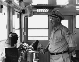
Capt. Charles Philbrook at the helm of the ferry Everett Libby.
No Cars
Monhegan Island, like Matinicus, usually has a winter population between 30 and 40, but the island does not have a regular car ferry. A few of the lobstering residents have trucks, but most residents use golf carts or just walk. The Laura B was put into service in 1952 by the founder of the Monhegan Boat Line, Capt. Earl Fields Sr. The former U.S. Army T boat, now owned by Capt. James Barstow, still makes the trip, joined by a bigger, newer vessel during the summer tourist rush.
“All 15 inhabited islands have different transportation realities,” said Murray. “There’s no such thing as ‘the islands’ when it comes to transportation issues.”
Seven islands of Casco Bay—Peaks, Little Diamond, Great Diamond, Long Island, Chebeague, Cliff, and Bailey— are served by Casco Bay Lines, a thriving private service at the time the Maine State Ferry Service began, but which foundered and went bankrupt in 1981. The quasi-municipal Casco Bay Transit Lines District took over the existing lines and ferries. It’s governed by a board of 12 directors who serve three-year terms. Fares are regulated by the Public Utilities Commission.
Mark Higgins, a Dover-Foxcroft native and 1992 graduate of Maine Maritime Academy, has headed up the Maine State Ferry Service for nearly two years. He finds the work more exciting than his previous tenure with American Dynamic in far-flung places such as Africa and Norway.
“We have 100 people working for the service, seven boats going all the time. The biggest challenge is having enough hours in the day, and no two days are alike,” he said. “For me, the service is indispensable, vital to Maine people as well as the economy. Islands are a big part of what makes Maine special. It’s a way of life. It’s important to provide service to people with the least disruption.”
Nancy Griffin is a freelance writer and editor who lives in Thomaston.
The Strange Nature of Horseshoe Crabs
The Strange Nature of Horseshoe Crabs
Covered in eyes and sensors, their blood has served medicine for decades
By Dana Wilde
Ages ago in the sea-green clear water of Chandler’s Cove on Chebeague Island, strange dark shapes were scuttling around the bottom. My seven-year-old face peeked out over the edge of the wharf, watching them. I remember my hands gripping the splintery planks.
Horseshoe crabs, the big people called them. Gliding along the sand down there in gangs. They didn’t look like horseshoes. The name puzzled me, the way you’re not sure what to think when someone tells you the bright star off Orion’s foot is a dog’s shoulder. It does not look like a dog. In the beginning, anyway. Horseshoe crabs were shaped only vaguely like horseshoes and definitely were not crabs, which run sideways on dangerous-looking legs and do not have tails like big stingers.
Well, more than a half-century later, I clearly see a dog bounding along behind Orion, and Limulus polyphemus’ rounded, ridged shell is close enough to horseshoe-shape that I can see that too. But the deeper they get in time, the stranger they seem.
Horseshoe crabs are among the most ancient of still-living beings. The earliest horseshoe crab fossil is from about 445 million years ago, which means they scuttled across the floors of Earth’s silent seas roughly 345 million years before any flower blossomed. They are the closest living relatives of the trilobites, who flourished during the first evolutionary explosion of multi-celled animals about 530 million years ago. And still living today as Limulus polyphemus, the Atlantic horseshoe crab, from Maine down the East Coast and the Gulf of Mexico to the Yucatan Peninsula, and as three other species in the Asian Pacific (Tachypleus gigas, Tachypleus tridentatus, and Carcinoscorpius rotundicauda).
Their hard shells led early biologists to classify them as crabs, but it’s been suspected for decades that horseshoe crabs are more closely related to spiders than to crustaceans such as lobsters and crabs. And in fact, a recent genetic study established that horseshoe crabs are, in fact, arachnids, meaning they’re aquatic evolutionary cousins of spiders, and now classified as a sister group to hooded tick spiders (aka ricinuleids, spiderlike relatives of ticks and mites).
Anatomically they are a living fascination. They’re the only marine animal known to breathe with book lungs, similar to those of spiders. Like other arachnids they have two body parts. The front is the prosoma (or cephalothorax) covered by the carapace, or hard, ridged shell, and underneath is its mouth flanked by ten legs (spiders have eight) for scuttling along the bottom. Hinged to the prosoma is the opisthosoma (or abdomen). Unlike other arachnids, horseshoe crabs have a long tail known as a telson, which is not a stinger at all but functions as a sort of rudder and as a lever the horseshoe crab uses to right itself if it gets overturned.
Horseshoe crabs also have a lot of eyes, including photo-receptors on the telson and seven eyes atop the carapace. The two lateral eyes are located about midway along the shell, either side of the central ridge. These are compound eyes, meaning they’re made up of about 1,000 individual receptors, or ommatidia, that collect light. Human eyes are simple rather than compound, meaning light is collected through one receptor, or adjustable lens. Insects such as dragonflies have compound eyes, but horseshoe crabs’ lateral eyes are unusual because they contain rods and cones similar in structure to that of humans. (In 1967 the Nobel prize in medicine was awarded for studies involving similarities between horseshoe crab and human eyes.) The two lateral eyes are used mainly during spawning, and their ommatidia can adjust to daytime and nighttime light conditions to help locate mates.
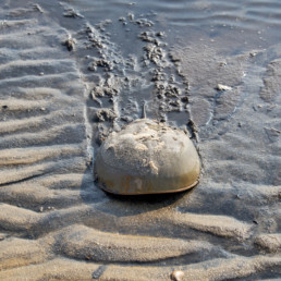
A rudimentary eye, used primarily by the embryo inside its egg, is located just behind each lateral median eye. At the front of the carapace are three eyes that can pick up ultraviolet light, which human eyes can’t, and that have special sensitivity to moonlight, which is important during spawning. Underneath, at the middle of the cephalothorax near the mouth and legs, are two more eyes whose function is not understood.
Along the top of the telson are arrays of simple photoreceptors, whose purpose also is not well understood, but they may help the animals synchronize light and dark cycles.
In fact, horseshoe crabs have sensory receptors all over their bodies, and those in the legs and two chelicerae (the small crablike claws used to place food such as worms, clams, even algae, in their mouths) can detect the chemical composition of seawater.
Seawater, of course, is vitally important to horseshoe crabs. Their migration cycle in Maine waters begins in spring, when the adults come in from deeper to shallower water (typically about ten to 12 feet, as under the Chandler’s Cove wharf). In May and June they make their way onto estuarine beaches to spawn, with the activity peaking on the full and new moon tides.
They typically come ashore as “amplexed mated pairs,” meaning the male is grasping the female from behind. She burrows into the sand to lay thousands of eggs. While she’s doing this, other males who are not clasping her may circulate nearby, releasing sperm in hopes of fertilizing the eggs too. This may happen over several nights and yield up to 100,000 eggs from a single female. The eggs hatch in two to four weeks, and the young horseshoe crabs head for the water during a high tide a month or so later.
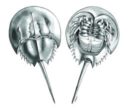
The young horseshoe crabs look like miniature versions of the adults. They spend the first few years of their lives on tidal flats and in shallower water, molting toward adulthood. Meanwhile, around September, the adults begin to make their way to deeper water for the winter. Horseshoe crabs can live to be 20 years old or more.
Strangely, horseshoe crabs have no immune system. In other words, they don’t produce antibodies to fight infections. Instead, they make chemicals that inactivate bacteria and viruses and that create clots to seal out further intruders. Researchers decades ago figured out how to use horseshoe blood (which is blue because of its copper content) to detect bacterial contamination, and it’s now used practically universally in medical serums, vaccines, intravenous drips, and even implant devices.
Horseshoe blood is harvested by capturing individuals and drawing it from their bodies with needles. Typically the animals are then returned to their waters, under the assumption that the horseshoe crabs are not permanently harmed. But studies have shown that in fact, tens of thousands of horseshoe crabs die despite harvesters’ efforts. Recently there has been a push for the medical community to use synthetic horseshoe blood, which has been around for more than a decade, and stop the harvest over conservation concerns.
Medical industry and bait harvests are playing a role in a concerning decline in horseshoe crab populations. Most reports indicate that Limulus polyphemus numbers overall have been dwindling significantly; at least one study concluded that populations south of roughly New England seem more or less stable, but they are declining in the Northeast. The Maine Wildlife Action plan of 2015 marks L. polyphemus as a Priority 1 Species of Greatest Conservation Need, listing among its threats unintentional catch by commercial trawling and agricultural, forestry, and other effluents. Other detrimental factors are habitat alteration (due, for example, to sea level rise and ocean acidification); storms and flooding (in which storms occurring during mating and egg laying result in mass strandings and loss of eggs); and temperature extremes. The Gulf of Maine is one of the fastest-warming bodies of salt water on Earth.
According to the Atlantic States Marine Fisheries Commission, which oversees the horseshoe crab fishery, 131,101 were landed for commercial bait in Maine, Massachusetts, and Rhode Island in 2016. The commission reports that along the East Coast, 575,760 horseshoe crabs were collected and brought to biomedical facilities in 2017, an estimated 15 percent of which subsequently died. The Maine Department of Marine Resources says it has no reports of horseshoe crab landings in Maine for the last ten years.
In Maine, a permit is required to harvest horseshoe crabs, with a daily limit of 25 per person. Possessing or damaging horseshoe crabs or their eggs is prohibited in Maine from
May 1 to Oct. 31.
I wasn’t thinking about conservation when I was seven years old, peering into the green water beneath the Chandler’s Cove wharf at the strange, strange creatures on the bottom. It seems like I already knew, somehow, that horseshoe crabs were ancient beyond ancient. That they had survived, if I could have known, the mass extinctions of life on Earth 250 million and 66 million years ago.
I thought they had been there for some kind of forever. And probably I thought, deep in the beginning of my own evolutionary innocence, that they’d be there forever yet, like starlight. I hope so.
Dana Wilde is a columnist, book reviewer, former news editor and college professor. His recent books are A Backyard Book of Spiders in Maine; Summer to Fall: Notes and Numina in the Maine Woods; and Nebulae: A Backyard Cosmography. He lives in Troy.